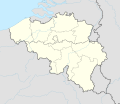
Պատկեր:Belgium adm location map.svg

Size of this PNG preview of this SVG file: 689 × 599 պիքսել. Այլ թույլտվությաններ: 276 × 240 պիքսել | 552 × 480 պիքսել | 883 × 768 պիքսել | 1177 × 1024 պիքսել | 2355 × 2048 պիքսել | 1136 × 988 պիքսել.
Սկզբնական նիշք (SVG-նիշք, անվանապես 1136 × 988 փիքսել, նիշքի չափը՝ 142 ԿԲ)
Նիշքի պատմություն
Մատնահարեք օրվան/ժամին՝ նիշքի այդ պահին տեսքը դիտելու համար։
| Օր/Ժամ | Մանրապատկեր | Օբյեկտի չափը | Մասնակից | Մեկնաբանություն | |
|---|---|---|---|---|---|
| ընթացիկ | 21:11, 27 Դեկտեմբերի 2021 |  | 1136 × 988 (142 ԿԲ) | NordNordWest | == {{int:filedesc}} == {{Information |description= {{de|1=Positionskarte von Belgien}} {{en|1=Location map of Belgium}} {{Location map series N |stretching=157,218 |top=51.8 |bottom=49.2 |left=2.2 |right=6.9 }} |source={{Own using}} * United States National Imagery and Mapping Agency data * World Data Base II data |date=2021-12-27 |author={{U|NordNordWest}} |other fields= }} {{Kartenwerkstatt}} == {{int:license-header}} == {{User:NordNordWest/LicenceMap}} [[Category:Location maps of Europe... |
Նիշքի օգտագործում
Հետևյալ 60 էջերը հղվում են այս նիշքին՝
- Աալստ
- Ալտեր
- Անգեն
- Անդերլեխտ
- Անտվերպեն
- Առլոն
- Բաարլե-Հերթոգ
- Բելգիայում ՅՈՒՆԵՍԿՕ-ի Համաշխարհային ժառանգության ցանկ
- Բլանկենբերգե
- Բրե (Լիմբուրգ)
- Բրյուգգե
- Բրյուսել
- Բևեր
- Գեղարվեստի թագավորական ակադեմիա (Անտվերպեն)
- Գենտ
- Գենտի համալսարան
- Դեյնզե
- Էկլո (Բելգիա)
- Էյպեն
- Էտերբեեկ
- Ժամբլու
- Ժետ
- Իպր
- Լա Լուվյեր
- Լիեժ
- Լինկեբեեկ
- Լյովեն
- Լյուվենի կաթոլիկ համալսարան
- Լոնդերզել
- Խրիմբերխեն
- Կորտրեյկ
- Հալեն
- Համոնտ Ախել
- Հասելտ
- Հարելբեկե
- Հոգե Կեմպեն ազգային պարկ
- Մեխելեն
- Մենեն
- Մեսեն
- Մետտե
- Մինի Եվրոպա
- Միջազգային իրավունքի ինստիտուտ
- Մոնս
- Նամյուր
- Շառլեռուա
- Սինթ-Նիքլաս
- Սխաարբեեկ
- Սպա (քաղաք)
- Վաթեռլոո
- Վատերմալ-Բուաֆոր
- Վարեգեմ
- Վևելգեմ
- Տուրնե
- Օստենդե
- Ֆլյորյուս
- Ֆորե (Բելգիա)
- Ֆուտբոլի Եվրոպայի առաջնություն 2000
- Կաղապար:Տեղորոշման քարտեզ Բելգիա
- Մոդուլ:Location map/data/Belgium
- Մոդուլ:Location map/data/Belgium/doc
Նիշքի համընդհանուր օգտագործում
Հետևյալ այլ վիքիները օգտագործում են այս նիշքը՝
- Օգտագործումը af.wikipedia.org կայքում
- Օգտագործումը als.wikipedia.org կայքում
- Օգտագործումը an.wikipedia.org կայքում
- Օգտագործումը ar.wikipedia.org կայքում
- Օգտագործումը arz.wikipedia.org կայքում
- Օգտագործումը ast.wikipedia.org կայքում
Տեսնել այս նիշքի ավելի համընդհանուր օգտագործումը:


