
Պատկեր:Location map Armenia Aragatsotn province.png
Ավելի բարձր կետաչափով տարբերակ չկա։
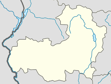
Location_map_Armenia_Aragatsotn_province.png (378 × 286 փիքսել, նիշքի չափը՝ 34 ԿԲ, MIME-տեսակը՝ image/png)
| Նկարագրում |
English: Տեղորոշման քարտեզ Հայաստան Արագածոտնի մարզ |
||
| Աղբյուր | Բեռնողի սեփական աշխատանք | ||
| Հեղինակ | Pandukht | ||
| Իրավունքներ (Նիշքի վերաօգտագործումը) |
|
Նիշքի պատմություն
Մատնահարեք օրվան/ժամին՝ նիշքի այդ պահին տեսքը դիտելու համար։
| Օր/Ժամ | Մանրապատկեր | Օբյեկտի չափը | Մասնակից | Մեկնաբանություն | |
|---|---|---|---|---|---|
| ընթացիկ | 10:01, 20 փետրվարի 2011 | | 378 × 286 (34 ԿԲ) | Pandukht | {{Information |Description ={{en|1=Տեղորոշման քարտեզ Հայաստան Արագածոտնի մարզ}} |Source ={{own}} |Author =Pandukht |Date = |Permission ={{PD-self}} |other_versions = |
Նիշքի օգտագործում
More than 100 pages use this file. The following list shows the first 100 pages that use this file only. A full list is available.
- Ագարակ (Արագածոտնի մարզ)
- Ագարակավան
- Ալագյազ
- Ակունք (Արագածոտնի մարզ)
- Աղձք
- Անտառուտ (գյուղ)
- Աշտարակ (քաղաք)
- Ավան (գյուղ)
- Ավշեն
- Արագած (Ապարանի շրջան)
- Արագածավան
- Արագածոտն (գյուղ)
- Արայի
- Արայի (լեռ)
- Արուճ
- Արտաշավան
- Արտենի
- Ափնագյուղ
- Բազմաղբյուր
- Բերքառատ
- Բյուրական
- Գառնահովիտ
- Գեղադիր (Արագածոտն)
- Գեղաձոր
- Գեղարոտ
- Գետափ (գյուղ, Արագածոտնի մարզ)
- Գյուղատեղի Քաղենի
- Դաշտադեմ (Արագածոտնի մարզ)
- Դավթաշեն (գյուղ)
- Դդմասար
- Դիան
- Դպրեվանք
- Եղիպատրուշ
- Երնջատափ
- Զարինջա
- Զովասար
- Թալին
- Թթուջուր (Արագածոտնի մարզ)
- Թլիկ
- Իրինդ
- Լեռնարոտ
- Լուսագյուղ (Արագածոտնի մարզ)
- Լուսաղբյուր (Արագածոտնի մարզ)
- Խնուսիկ
- Ծաղկաշեն (Արագածոտնի մարզ)
- Ծաղկասար
- Ծիլքար
- Կաթնաղբյուր (Արագածոտնի մարզ)
- Կայք (Արագածոտնի մարզ)
- Կարբի
- Կարին (գյուղ)
- Կոշ
- Հակո
- Հարթավան
- Հնաբերդ (Արագածոտնի մարզ)
- Ձորագլուխ
- Ձորագյուղ (Արագածոտնի մարզ)
- Ղազարավան
- Մաստարա
- Մելիքգյուղ
- Միջնատուն
- Միրաք
- Մուղնի
- Նիգավան
- Նիգատուն
- Նոր Ամանոս
- Նոր Եդեսիա
- Նորաշեն (Արագածոտն)
- Շամիրամ (գյուղ)
- Շենավան (Արագածոտնի մարզ)
- Շենկանի
- Շղարշիկ
- Շողակն
- Ոսկեթաս
- Ոսկեհատ (Արագածոտնի մարզ)
- Ուշի
- Ուջան
- Չքնաղ (գյուղ)
- Ջամշլու
- Ջրամբար (գյուղ)
- Ռյա Թազա
- Սադունց
- Սաղմոսավան
- Սանգյառ
- Սասունիկ
- Սարալանջ (Արագածոտնի մարզ)
- Սիփան (գյուղ)
- Սուրբ Աստվածածին եկեղեցի (Կարբի)
- Սուրբ Գևորգ եկեղեցի (Մուղնի)
- Սուրբ Հովհաննես եկեղեցի (Ոսկեվազ)
- Սուրբ Մարինե եկեղեցի (Աշտարակ)
- Սուրբ Սարգիս եկեղեցի (Աշտարակ)
- Վարդաբլուր (Արագածոտնի մարզ)
- Վերին Սասնաշեն
- Վերին Սասունիկ
- Տեղեր
- Ցամաքասար
- Փարպի
- Քուչակ
- Օհանավան
View more links to this file.
Նիշքի համընդհանուր օգտագործում
Հետևյալ այլ վիքիները օգտագործում են այս նիշքը՝
- Օգտագործումը ba.wikipedia.org կայքում
- Օգտագործումը ce.wikipedia.org կայքում
- Օգտագործումը fa.wikipedia.org կայքում
- آشتاراک
- آپاران
- تالین (ارمنستان)
- تساغکاشن، آراگاتسوتن
- تتوجور، آراگاتسوتن
- واردابلور (آراگاتسوتن)
- واردنیس، آراگاتسوتن
- واردنوت
- ورین بازمابرد
- ورین ساسناشن
- ورین ساسونیک
- ورخنی کلکوت
- آراگاتس، آراگاتسوتن
- آرایی
- آپنا
- آنتاروت
- آگاراکاوان
- آگاراک، آراگاتسوتن
- آراگاتسوتن (روستا)
- آرتاشاوان
- آرتنی
- آروچ
- آشناک
- آوان، آراگاتسوتن
- آوشن
- آرووت
- بازماغبیور
- برکارات
- بیوراکان
- چارچاکیس
- چکناغ
- داشتادم
- داوتاشن
- ددماسار
- دیان، آراگاتسوتن
- دپروانک
- جوراگلوخ
- گارناهوویت
- گغادیر
- گغادزور
- گغاروت
- گتاپ
- غازاراوان
- هاکو
- هارتاوان
- هاتساشن
- هنابرد
- ایریند
Տեսնել այս նիշքի ավելի համընդհանուր օգտագործումը: