
Պատկեր:UK Outline and Flag.svg

Size of this PNG preview of this SVG file: 407 × 600 պիքսել. Այլ թույլտվությաններ: 163 × 240 պիքսել | 326 × 480 պիքսել | 521 × 768 պիքսել | 695 × 1024 պիքսել | 1390 × 2048 պիքսել | 661 × 974 պիքսել.
Սկզբնական նիշք (SVG-նիշք, անվանապես 661 × 974 փիքսել, նիշքի չափը՝ 109 ԿԲ)
| Նկարագրում |
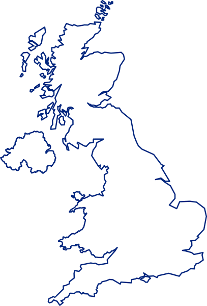
English: A map of the United Kingdom, overlaid with the UK flag.
Русский: Флаг-карта Соединённого Королевства |
||
| Թվական | |||
| Աղբյուր | Բեռնողի սեփական աշխատանք | ||
| Հեղինակ | Inductiveload | ||
| Իրավունքներ (Նիշքի վերաօգտագործումը) |
|
||
| Այլ մեկնակերպներ |
 |
||
| SVG genesis | Սա վեկտոր գրաֆիկական պատկեր է ստեղծված է եղել Inkscape օգնությամբ: . |
Նիշքի պատմություն
Մատնահարեք օրվան/ժամին՝ նիշքի այդ պահին տեսքը դիտելու համար։
| Օր/Ժամ | Մանրապատկեր | Օբյեկտի չափը | Մասնակից | Մեկնաբանություն | |
|---|---|---|---|---|---|
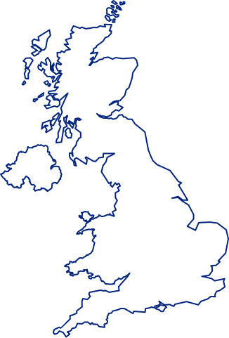
| ընթացիկ | 15:14, 24 Հուլիսի 2021 | | 661 × 974 (109 ԿԲ) | GPinkerton | Improve flag geometry, remove Isle of Man (not strictly part of the UK). Shetland (definitely a part) still missing ... |
| 20:40, 10 հունվարի 2015 |  | 720 × 1000 (130 ԿԲ) | AnonMoos | Reverted to version as of 09:28, 15 January 2012 -- unfortunately, the new upload is less clear when displayed at a small size, and filesize was bloated over 1000% | |
| 16:03, 9 հունվարի 2015 |  | 419 × 750 (1,71 ՄԲ) | Stasyan117 | border and islands | |
| 09:28, 15 հունվարի 2012 |  | 720 × 1000 (130 ԿԲ) | Gajmar | Blue borders | |
| 19:33, 3 փետրվարի 2008 |  | 720 × 1000 (129 ԿԲ) | Inductiveload | fix white fill on borders | |
| 19:23, 3 փետրվարի 2008 |  | 720 × 1000 (100 ԿԲ) | Inductiveload | {{Information |Description=A map of the United Kingdom, overlaid with the UK flag. |Source=self-made |Date=03/02/2008 |Author= Inductiveload |Permission={{PD-self}} |other_versions= }} Category:Maps of the United Kingdom |
Նիշքի օգտագործում
Հետևյալ 56 էջերը հղվում են այս նիշքին՝
- Ալբիոն
- Ալիստեր Դարլինգ
- Անգլաշոտլանդական սահման
- Անգլո-բուրական պատերազմ
- Անգլո-եգիպտական պայմանագիր
- Աշբերն
- Աքս (գետ)
- Բանբերի
- Բանքեթինգ հաուս
- Բարթլիի ջրամբար
- Բեն Նևիս
- Բոզլիի ջրամբար
- Բրիստոլի ծոց
- Բրիտանական Գվիանա
- Բրիտանական բանակ
- Գալաշիլս
- Գրինվիչ
- Դեյվիդ Միլիբենդ
- Դոմինիոն
- Երկարատև պառլամենտ
- Էդմունդ I
- Էթելսթան
- Էթելրեդ II
- Էյվբերի
- Թերքս և Քայքոս կղզիներ
- Թրեյդ-Յունիոնների կոնգրես
- Իթըն քոլեջ
- Լուդիտներ
- Ծովակալության կամար
- Կանութ Դանիացի
- Հարավային Ջորջիա և Հարավային Սանդվիչյան կղզիներ
- Հարինգի (Լոնդոնի շրջան)
- Հացի օրենքներ
- Մեծ Բրիտանիայի զինանշան
- Մեծ Լոնդոն
- Մեծ Մանչեսթեր
- Միացյալ Թագավորության գաղտնի հետախուզական ծառայություն
- Միացյալ Թագավորության գետերի ցանկ
- Յուսթեն թաուեր
- Նին (գետ)
- Նոր տրեդ-յունիոններ
- Շոտլանդիայի սիթի-քաղաքներ
- Պանծալի հեղափոխություն
- Ռոքի Հիլ
- Սուրբ Ավգուստինի աբբայություն
- Սևեռն
- Վելինգտոնի կամար
- Վեսթմինսթեր
- Վեստմինստերյան ստատուտ (1931)
- Վեստմինստերյան տաճար
- Վիգեր
- Քելսո
- Քլայդ (գետ)
- Քոլդստրիմ
- Օլսթերի գաղութացում
- Կաղապար:Միացյալ Թագավորություն-անավարտ
Նիշքի համընդհանուր օգտագործում
Հետևյալ այլ վիքիները օգտագործում են այս նիշքը՝
- Օգտագործումը ace.wikipedia.org կայքում
- Օգտագործումը ar.wikipedia.org կայքում
- غرينتش
- جزر الأنتيل الكبرى
- غيرنزي
- قائمة مدن المملكة المتحدة
- خط الطول الأول (غرينتش)
- إكسمنستر
- جزر كايمان
- ويكيبيديا:صناديق المستخدم/بلدان
- دمبارتون
- شابينساي
- سان بيتر بورت
- بروفيدنسياليس
- جزيرة الطيور (المملكة المتحدة)
- سندرلاند
- بيليمينا
- تورفين
- تلة كليف
- الجمعية الجغرافية الملكية
- لوستويزيل
- نهر فاوي
- بولستيد
- كادسدن
- إنفرنيس
- أسكوت
- سالفورد
- وايت تشابل
- هارلو
- توتون
- دوكنج (نورفولك)
- سودرك
- هامرسميث
- لافيونا
- إيلي (كامبريدجشير)
- برايتون أند هوف
- تشيلمسفورد (إسكس)
- تشيتشستر
- ريبون (شمال يوركشير)
- مدينة ولز (إنجلترا)
- خليج ماساشوستس
- مستخدم:Sylvia Ford
- دونكاستر
- ويندرمير (كمبريا)
- ويندرمير
- وايتستابل
- ساوث سي
- لوثيان الشرقية
- آلدرني
- شوريهام
Տեսնել այս նիշքի ավելի համընդհանուր օգտագործումը: