
Պատկեր:Map of Indonesia Demis.png

Նախադիտման չափ՝ 800 × 359 պիքսել։ Այլ թույլտվությաններ: 320 × 144 պիքսել | 640 × 287 պիքսել | 1492 × 670 պիքսել.
Սկզբնական նիշք (1492 × 670 փիքսել, նիշքի չափը՝ 345 ԿԲ, MIME-տեսակը՝ image/png)
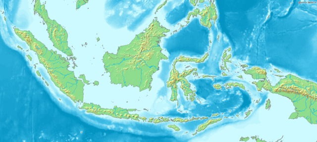
Map of Indonesia
Bounding box West 93°, South -12°, East 142°, North 10°. Center at 1°00′00″S 117°30′00″E / 1.00000°S 117.50000°E.
This image is in the public domain because it came from the site https://www.demis.nl/products/web-map-server/examples/ and was released by the copyright holder. Permission is granted to copy, distribute and/or modify this map since it is based on free of copyright images from: www.demis.nl. See also approval email on de.wp and its clarification.
|
| This work has been released into the public domain by its copyright holder, www.demis.nl. This applies worldwide. In some countries this may not be legally possible; if so: www.demis.nl grants anyone the right to use this work for any purpose, without any conditions, unless such conditions are required by law.
|
Նիշքի պատմություն
Մատնահարեք օրվան/ժամին՝ նիշքի այդ պահին տեսքը դիտելու համար։
| Օր/Ժամ | Մանրապատկեր | Օբյեկտի չափը | Մասնակից | Մեկնաբանություն | |
|---|---|---|---|---|---|
| ընթացիկ | 17:48, 20 Դեկտեմբերի 2006 | | 1492 × 670 (345 ԿԲ) | Mats Halldin~commonswiki | Map of Indonesia Bounding box West 93°, South -12°, East 142°, North 10°. Center at {{coor d|1.00000|S|117.50000|E|scale:13200000}}. {{demis-pd}} Category:Maps of Indonesia |
Նիշքի օգտագործում
Հետևյալ էջը հղվում է այս նիշքին՝
Նիշքի համընդհանուր օգտագործում
Հետևյալ այլ վիքիները օգտագործում են այս նիշքը՝
- Օգտագործումը ar.wikipedia.org կայքում
- Օգտագործումը bg.wikipedia.org կայքում
- Օգտագործումը bn.wikipedia.org կայքում
- Օգտագործումը es.wikipedia.org կայքում
- Օգտագործումը et.wikipedia.org կայքում
- Օգտագործումը eu.wikipedia.org կայքում
- Օգտագործումը fr.wikipedia.org կայքում
- Օգտագործումը hr.wikipedia.org կայքում
- Օգտագործումը id.wikipedia.org կայքում
- Օգտագործումը ja.wikipedia.org կայքում
- Օգտագործումը km.wikipedia.org կայքում
- Օգտագործումը ko.wikipedia.org կայքում
- Օգտագործումը la.wikipedia.org կայքում
- Օգտագործումը nl.wikipedia.org կայքում
- Օգտագործումը pl.wikipedia.org կայքում
- Օգտագործումը pnb.wikipedia.org կայքում
- Օգտագործումը sq.wikipedia.org կայքում
- Օգտագործումը uk.wikipedia.org կայքում
- Օգտագործումը vep.wikipedia.org կայքում
- Օգտագործումը vi.wikipedia.org կայքում