
Պատկեր:Nouvelle-France map-fr.svg

Սկզբնական նիշք (SVG-նիշք, անվանապես 1530 × 1090 փիքսել, նիշքի չափը՝ 375 ԿԲ)
Ամփոփում
| Նկարագրում |
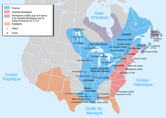
Català: Mapa de la Nova França sobre 1754-1755 English: Map of New France about 1750 using modern political boundaries Español: Mapa de la Nueva Francia cerca de 1750. Français : Carte de la Nouvelle-France vers 1754-1755 Norsk nynorsk: Kart over Ny Frankrike (ca 1754-1755) Русский: Карта Французских колоний в Америке 1750 中文(中国大陆): 1750年左右的新法兰西地图,附现代边界。 العربية : خريطة فرنسا الجديدة حوالي عام 1750 باستخدام الحدود السياسية الحديثة |
||
| Թվական | |||
| Աղբյուր |
travail personnel from Image:Nouvelle-France1750.png 1) Les Villes françaises du Nouveau Monde : des premiers fondateurs aux ingénieurs du roi, XVIe-XVIIIe siècles / sous la direction de Laurent Vidal et Emilie d'Orgeix /Éditeur : Paris : Somogy 1999. 2) Canada-Québec 1534-2000/ Jacques Lacoursière, Jean Provencher et Denis Vaugeois/Éditeur: Sillery (Québec): Septentrion 2000. |
||
| Հեղինակ | Pinpin | ||
| Այլ մեկնակերպներ |
File:Nouvelle-France map-fr.svg has 4 translations.
Other related versions:[]
|


|
Այս SVG ֆայլ օգտագործում է զետեղված տեքստ, որը կարելի է հեշտ թարգմանել ձեր լեզվի վրա using [toolforge:svgtranslate/File:Nouvelle-France_map-fr.svglink this automated tool]: Իմացեք ավելին: You can also download it and translate it manually using a text editor. |
This file is translated using SVG For most Wikipedia projects, you can embed the file normally (without a To translate the text into your language, you can use the SVG Translate tool. Alternatively, you can download the file to your computer, add your translations using whatever software you're familiar with, and re-upload it with the same name. You will find help in Graphics Lab if you're not sure how to do this. |
Արտոնագրում

|
Այս վավերագրման պատճենահանման, տարածման և/կամ ձևափոխման թույլտվություն կամ լիցենզիայի GNU FDL պայմաններով 1.2 մեկնակերպի կամ ավելի ուշ, հրատարակված Ազատ ծրագրային ապահովության հիմնադրամում, առանց անփոփոխելի հատվածների, առանց բնագիրների, որոնք տեղադրված են առաջին և վերջին շապիկներում: Լիցենզիայի պատճենը գտնվում է GNU Free Documentation License հատվածում: |
- Դուք ազատ եք՝
- կիսվել ստեղծագործությամբ – պատճենել, տարածել և փոխանցել այս աշխատանքը։
- վերափոխել – ադապտացնել աշխատանքը
- Պահպանելով հետևյալ պայմանները'
- հղում – Դուք պետք է նշեք հեղինակի (իրավատիրոջ) հղումը:
- համանման տարածում – Եթե դուք ձևափոխում եք, փոխակերպում, կամ այս աշխատանքի հիման վրա ստեղծում եք նոր աշխատանք, ապա ձեր ստեղծածը կարող է տարածվել միայն նույն կամ համարժեք թույլատրագրով։
Նիշքի պատմություն
Մատնահարեք օրվան/ժամին՝ նիշքի այդ պահին տեսքը դիտելու համար։
| Օր/Ժամ | Մանրապատկեր | Օբյեկտի չափը | Մասնակից | Մեկնաբանություն | |
|---|---|---|---|---|---|
| ընթացիկ | 17:12, 18 Սեպտեմբերի 2023 | | 1530 × 1090 (375 ԿԲ) | JoanSMF | File uploaded using svgtranslate tool (https://svgtranslate.toolforge.org/). Added translation for ca. |
| 17:09, 18 Սեպտեմբերի 2023 |  | 1530 × 1090 (370 ԿԲ) | JoanSMF | File uploaded using svgtranslate tool (https://svgtranslate.toolforge.org/). Added translation for ca. | |
| 19:40, 14 Դեկտեմբերի 2022 |  | 1530 × 1090 (366 ԿԲ) | Tcr25 | Fort Rosaile in wrong location; add Fort St-Jean-Baptiste | |
| 02:14, 23 Օգոստոսի 2021 |  | 1530 × 1090 (353 ԿԲ) | Praça de Maio | File uploaded using svgtranslate tool (https://svgtranslate.toolforge.org/). Added translation for tr. | |
| 02:13, 23 Օգոստոսի 2021 |  | 1530 × 1090 (351 ԿԲ) | Praça de Maio | File uploaded using svgtranslate tool (https://svgtranslate.toolforge.org/). Added translation for tr. | |
| 11:30, 5 Ապրիլի 2020 |  | 1530 × 1090 (343 ԿԲ) | Les Meloures | File uploaded using svgtranslate tool (https://tools.wmflabs.org/svgtranslate/). Added translation for lb. | |
| 11:15, 5 Ապրիլի 2020 |  | 1530 × 1090 (343 ԿԲ) | Les Meloures | File uploaded using svgtranslate tool (https://tools.wmflabs.org/svgtranslate/). Added translation for lb. | |
| 12:59, 12 Մարտի 2020 |  | 1530 × 1090 (326 ԿԲ) | Gumruch | Reverted to version as of 11:30, 24 September 2018 (UTC) | |
| 12:58, 12 Մարտի 2020 |  | 1530 × 1090 (342 ԿԲ) | Gumruch | File uploaded using svgtranslate tool (https://tools.wmflabs.org/svgtranslate/). Added translation for cs. | |
| 11:30, 24 Սեպտեմբերի 2018 |  | 1530 × 1090 (326 ԿԲ) | GrandCelinien | Reverted to version as of 22:43, 3 December 2011 (UTC) - La carte est toute floue, ce n'est même plus une vraie SVG. |
Նիշքի օգտագործում
Հետևյալ էջը հղվում է այս նիշքին՝
Նիշքի համընդհանուր օգտագործում
Հետևյալ այլ վիքիները օգտագործում են այս նիշքը՝
- Օգտագործումը ang.wikipedia.org կայքում
- Օգտագործումը be-tarask.wikipedia.org կայքում
- Օգտագործումը be.wikipedia.org կայքում
- Օգտագործումը bg.wikipedia.org կայքում
- Օգտագործումը ca.wikipedia.org կայքում
- Օգտագործումը co.wikipedia.org կայքում
- Օգտագործումը cs.wikipedia.org կայքում
- Օգտագործումը de.wikipedia.org կայքում
- Օգտագործումը el.wikipedia.org կայքում
- Օգտագործումը eo.wikipedia.org կայքում
- Օգտագործումը fr.wikipedia.org կայքում
- Discussion:Québec/Archive 2
- René-Robert Cavelier de La Salle
- Liste des colonies françaises
- Histoire du Canada
- Pierre André de Suffren
- Traité de Versailles (1783)
- Empire colonial français
- Royaume de France
- Histoire de l'Acadie
- Quelques arpents de neige
- Territoires français du nord
- Guerre de la Conquête
- États-Unis
- Franco-Américains
- Utilisateur:Urban/cartes
- Colonisation française des Amériques
- Utilisateur:Xinpeijin/Aide:Captcha
- Portail:Nouvelle-France/Carte de la Nouvelle-France
- Wikipédia:Atelier graphique/Cartes/Archives/décembre 2007
- Liste des forts de la Nouvelle-France
- Discussion utilisateur:The Ogre
- En canot sur les chemins d'eau du Roi
- Vieilles colonies
- Portail:Nouvelle-France
- Histoire de la Louisiane
- Immigration française à Porto Rico
- Histoire de France
- Ferme d'Occident
- Alliance franco-indienne (Amérique)
- Wikipédia:Atelier graphique/Cartes/Archives/Demandes mises en sommeil/Amériques
- Projet:Nouvelle-France/Brasserie Port-Royal/Archives 8
- Colonisation basque des Amériques
Տեսնել այս նիշքի ավելի համընդհանուր օգտագործումը: