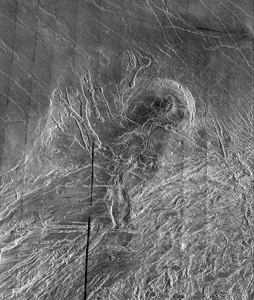
Պատկեր:Lakshmi Planum and Siddons Patera PIA00240.jpg
Արտաքին տեսք

Նախադիտման չափ՝ 507 × 599 պիքսել։ Այլ թույլտվությաններ: 203 × 240 պիքսել | 406 × 480 պիքսել | 650 × 768 պիքսել | 866 × 1024 պիքսել | 1732 × 2048 պիքսել | 3073 × 3633 պիքսել.
Սկզբնական նիշք (3073 × 3633 փիքսել, նիշքի չափը՝ 3,76 ՄԲ, MIME-տեսակը՝ image/jpeg)
Նիշքի պատմություն
Մատնահարեք օրվան/ժամին՝ նիշքի այդ պահին տեսքը դիտելու համար։
| Օր/Ժամ | Մանրապատկեր | Օբյեկտի չափը | Մասնակից | Մեկնաբանություն | |
|---|---|---|---|---|---|
| ընթացիկ | 05:38, 7 Ապրիլի 2008 |  | 3073 × 3633 (3,76 ՄԲ) | Bryan Derksen | {{Information |Description={{en|This image is a full-resolution mosaic of several Magellan images and is centered at 61 degrees north latitude and 341 degrees east longitude. The image is 250 kilometers wide (150 miles). The radar smooth region in the nor |
Նիշքի օգտագործում
Հետևյալ էջը հղվում է այս նիշքին՝
Նիշքի համընդհանուր օգտագործում
Հետևյալ այլ վիքիները օգտագործում են այս նիշքը՝
- Օգտագործումը be.wikipedia.org կայքում
- Օգտագործումը bn.wikipedia.org կայքում
- Օգտագործումը cs.wikipedia.org կայքում
- Օգտագործումը fi.wikipedia.org կայքում
- Օգտագործումը fr.wikipedia.org կայքում
- Օգտագործումը hi.wikipedia.org կայքում
- Օգտագործումը ja.wikipedia.org կայքում
- Օգտագործումը nl.wikipedia.org կայքում
- Օգտագործումը ru.wikipedia.org կայքում
- Օգտագործումը sr.wikipedia.org կայքում
- Օգտագործումը ta.wikipedia.org կայքում
- Օգտագործումը uk.wikipedia.org կայքում
- Օգտագործումը zh.wikipedia.org կայքում


