
Պատկեր:Spain Valencian Community location map.svg

Size of this PNG preview of this SVG file: 442 × 600 պիքսել. Այլ թույլտվությաններ: 177 × 240 պիքսել | 353 × 480 պիքսել | 566 × 768 պիքսել | 754 × 1024 պիքսել | 1509 × 2048 պիքսել | 512 × 695 պիքսել.
Սկզբնական նիշք (SVG-նիշք, անվանապես 512 × 695 փիքսել, նիշքի չափը՝ 538 ԿԲ)
Ամփոփում
| Նկարագրում |
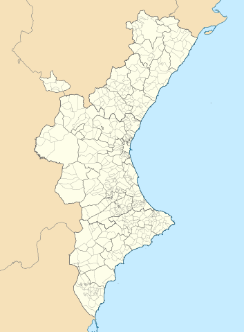
Català: Mapa de localització del País Valencià
Projecció equirrectangular, N/S estirada 130 %. Extrems geogràfics al mapa:
English: Location map of the Land of Valencia
Equirectangular projection, N/S stretching 130 %. Geographic limits of the map:
Español: Mapa de localización de la Comunidad Valenciana
Proyección equirrectangular, N/S estirada 130 %. Límites geográficos del mapa:
|
|
| Թվական | ||
| Աղբյուր | Own work based on: EspañaLoc.svg by HansenBCN, and Own work based on: Mapa de localització a les comarques valencianes.svg by Martorell | |
| Հեղինակ | Miguillen and Martorell | |
| SVG genesis | Այս մասշտաբավորելի վեկտորային գրաֆիկայի նիշքի ելակետային կոդը վավեր է. Սա վեկտոր գրաֆիկական պատկեր է ստեղծված է եղել Inkscape օգնությամբ: .
|
Արտոնագրում
Miguillen, սույն աշխատանքի հեղինակային իրավունքների տերը, այսուհետ այն հրատարակում է հետևյալ արտոնագրի պայմաններով՝
Այս նիշքը հասանելի է Creative Commons Attribution-Share Alike 3.0 Unported արտոնագրի ներքո:
Հղում: Miguillen
- Դուք ազատ եք՝
- կիսվել ստեղծագործությամբ – պատճենել, տարածել և փոխանցել այս աշխատանքը։
- վերափոխել – ադապտացնել աշխատանքը
- Պահպանելով հետևյալ պայմանները'
- հղում – Դուք պետք է նշեք հեղինակի (իրավատիրոջ) հղումը:
- համանման տարածում – Եթե դուք ձևափոխում եք, փոխակերպում, կամ այս աշխատանքի հիման վրա ստեղծում եք նոր աշխատանք, ապա ձեր ստեղծածը կարող է տարածվել միայն նույն կամ համարժեք թույլատրագրով։
Նիշքի պատմություն
Մատնահարեք օրվան/ժամին՝ նիշքի այդ պահին տեսքը դիտելու համար։
| Օր/Ժամ | Մանրապատկեր | Օբյեկտի չափը | Մասնակից | Մեկնաբանություն | |
|---|---|---|---|---|---|
| ընթացիկ | 07:29, 9 Սեպտեմբերի 2022 | | 512 × 695 (538 ԿԲ) | Martorell | Added borders of comarques. |
| 14:39, 25 Մայիսի 2010 |  | 512 × 695 (494 ԿԲ) | Miguillen | == {{int:filedesc}} == {{Information |Description={{en|Location map of Valencian Community}} Equirectangular projection, N/S stretching 130 %. Geographic limits of the map: * N: 40.885909° N * S: 37.698098° N * W: 1.95368 |
Նիշքի օգտագործում
Նիշքի համընդհանուր օգտագործում
Հետևյալ այլ վիքիները օգտագործում են այս նիշքը՝
- Օգտագործումը ar.wikipedia.org կայքում
- Օգտագործումը ast.wikipedia.org կայքում
- Օգտագործումը azb.wikipedia.org կայքում
- Օգտագործումը ba.wikipedia.org կայքում
- Օգտագործումը bg.wikipedia.org կայքում
- Օգտագործումը bn.wikipedia.org կայքում
- Օգտագործումը ca.wikipedia.org կայքում
- Usuari:PereBot/cobertura/País Valencià 2/ranking
- Usuari:PereBot/cobertura/País Valencià 2/an
- Usuari:PereBot/cobertura/País Valencià 2/ca
- Usuari:PereBot/cobertura/País Valencià 2/de
- Usuari:PereBot/cobertura/País Valencià 2/en
- Usuari:PereBot/cobertura/País Valencià 2/es
- Usuari:PereBot/cobertura/País Valencià 2/eu
- Usuari:PereBot/cobertura/País Valencià 2/fr
- Usuari:PereBot/cobertura/País Valencià 2/nl
Տեսնել այս նիշքի ավելի համընդհանուր օգտագործումը: