
Պատկեր:Pichincha.png
Նախադիտման չափ՝ 800 × 534 պիքսել։ Այլ թույլտվությաններ: 320 × 214 պիքսել | 640 × 427 պիքսել | 1024 × 684 պիքսել | 1280 × 855 պիքսել | 1920 × 1282 պիքսել.
Սկզբնական նիշք (1920 × 1282 փիքսել, նիշքի չափը՝ 96 ԿԲ, MIME-տեսակը՝ image/png)
Ամփոփում
| Նկարագրում |
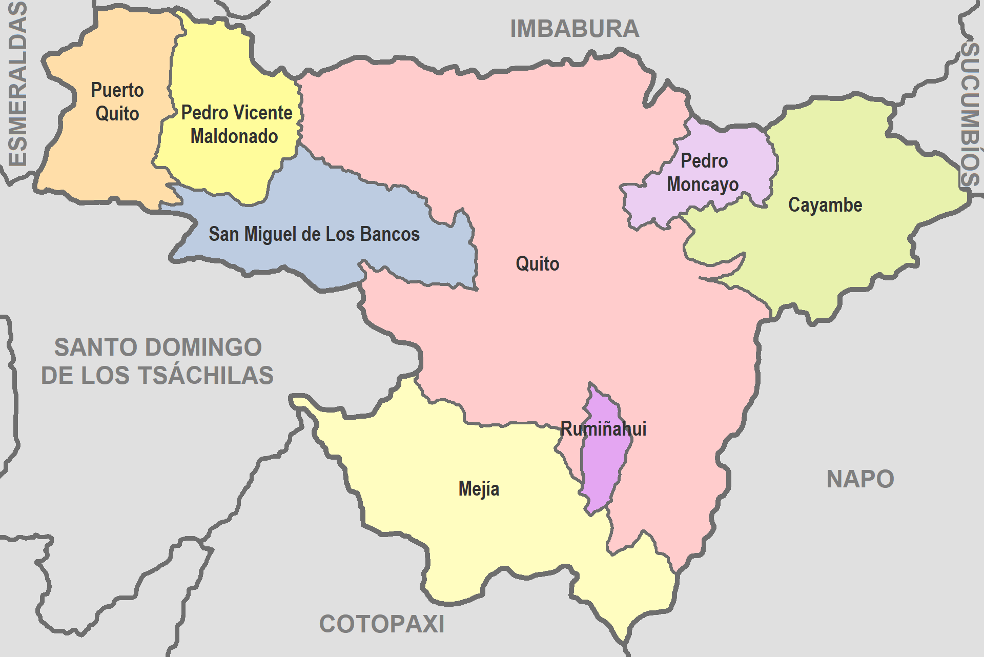
English: Map of Pichincha
Español: Mapa de Pichincha |
| Թվական | |
| Աղբյուր | De mi trabajo |
| Հեղինակ | David C. S. |
Արտոնագրում
Ես, սույն աշխատանքի հեղինակային իրավունքների տերը, այսուհետ այն հրատարակում եմ հետևյալ արտոնագրի ներքո։
| This file is made available under the Creative Commons CC0 1.0 Universal Public Domain Dedication. | |
| The person who associated a work with this deed has dedicated the work to the public domain by waiving all of their rights to the work worldwide under copyright law, including all related and neighboring rights, to the extent allowed by law. You can copy, modify, distribute and perform the work, even for commercial purposes, all without asking permission.
|
Նիշքի պատմություն
Մատնահարեք օրվան/ժամին՝ նիշքի այդ պահին տեսքը դիտելու համար։
| Օր/Ժամ | Մանրապատկեր | Օբյեկտի չափը | Մասնակից | Մեկնաբանություն | |
|---|---|---|---|---|---|
| ընթացիկ | 03:32, 14 Հունիսի 2022 | | 1920 × 1282 (96 ԿԲ) | David C. S. | Imagen |
| 04:07, 26 Սեպտեմբերի 2017 |  | 707 × 457 (37 ԿԲ) | Berposen | Actualizando los limites de la provincia de Santo Domingo de los Tsachilas. | |
| 21:16, 10 Հոկտեմբերի 2011 |  | 707 × 457 (33 ԿԲ) | David C. S. | Imagen | |
| 23:52, 6 Ապրիլի 2011 |  | 601 × 384 (39 ԿԲ) | David C. S. | {{Information |Description ={{en|1=Map of Pichincha}} {{es|1=Mapa de Pichincha}} |Source =De mi trabajo |Author =David C. S. |Date =2011-04-03 |Permission = |other_versions = }} |
Նիշքի օգտագործում
Այս նիշքին օգտագործող էջեր չկան։