Պատկեր:North America second level political division 2.svg

Page contents not supported in other languages.
Վիքիպեդիայից՝ ազատ հանրագիտարանից

Սկզբնական նիշք(SVG-նիշք, անվանապես 512 × 596 փիքսել, նիշքի չափը՝ 132 ԿԲ)

Այս նիշքը տեղադրված է Վիքիպահեստում է և այն կարող է օգտագործվել այլ նախագծերի կողմից։ Վիքիպահեստում նիշքի մասին տեղեկությունների հիմնական մասը ներկայացված է ստորև։

Ամփոփում

Նկարագրում
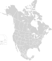
English: Map of North America and its second-level political divisions. Canadian provinces, US and Mexican states. Canada, Mexico, United States.

Non-contiguous parts of a states/provinces are "grouped" together with the main area of the state/provinces, so any state/provinces can be coloured in completion with one click anywhere on the state/provinces's area.

Also, all states/provinces have a "id" attached to them, making them easy to find. Select "find" and then enter in the state/provinces's ISO 3166-2 code in the "id" field to find it. The codes can be found here (Canada), here (USA) and here (Mexico).
Թվական
Աղբյուր

Canada and US map: BlankMap-USA-states-Canada-provinces, HI closer.svg by Lokal_Profil.
Mexico map: Mexico template.svg by Mario Fuente Cid
Combined by Alex Covarrubias.

 
This vector image was created with Inkscape, and then manually edited
.
 
W3C-validity not checked.
Հեղինակ Alex Covarrubias
Իրավունքներ
(Նիշքի վերաօգտագործումը)
w:en:Creative Commons
հղում համանման տարածում
This file is licensed under the Creative Commons Attribution-Share Alike 2.5 Generic license.
Դուք ազատ եք՝
  • կիսվել ստեղծագործությամբ – պատճենել, տարածել և փոխանցել այս աշխատանքը։
  • վերափոխել – ադապտացնել աշխատանքը
Պահպանելով հետևյալ պայմանները'
  • հղում – Դուք պետք է նշեք հեղինակի (իրավատիրոջ) հղումը:
  • համանման տարածում – Եթե դուք ձևափոխում եք, փոխակերպում, կամ այս աշխատանքի հիման վրա ստեղծում եք նոր աշխատանք, ապա ձեր ստեղծածը կարող է տարածվել միայն նույն կամ համարժեք թույլատրագրով։
Այլ մեկնակերպներ

Derivative works of this file:

Captions

Add a one-line explanation of what this file represents

Items portrayed in this file

պատկերված

7 Հոկտեմբերի 2007

Նիշքի պատմություն

Մատնահարեք օրվան/ժամին՝ նիշքի այդ պահին տեսքը դիտելու համար։

Օր/ԺամՄանրապատկերՕբյեկտի չափըՄասնակիցՄեկնաբանություն
ընթացիկ01:51, 23 Նոյեմբերի 202001:51, 23 Նոյեմբերի 2020 տարբերակի մանրապատկերը512 × 596 (132 ԿԲ)Ponderosapine210Added the prominent islands of Manitoulin (Ontario) and Isle Royale (Michigan) to the Great Lakes.
23:07, 1 Հունիսի 201923:07, 1 Հունիսի 2019 տարբերակի մանրապատկերը512 × 596 (130 ԿԲ)Fluffy89502added territories, made DC visible, adjusted mexican borders
12:23, 4 Ապրիլի 201412:23, 4 Ապրիլի 2014 տարբերակի մանրապատկերը1712 × 1992 (270 ԿԲ)Lommesmade the borders between the mexican subdivisions the same size as their canadian / us counterparts.
23:23, 8 Դեկտեմբերի 200723:23, 8 Դեկտեմբերի 2007 տարբերակի մանրապատկերը1712 × 1992 (327 ԿԲ)Lokal ProfilCode cleanup
07:55, 7 Հոկտեմբերի 200707:55, 7 Հոկտեմբերի 2007 տարբերակի մանրապատկերը1712 × 1992 (342 ԿԲ)AlexCovarrubias== Summary == {{Information |Description=Map of North America and its second-level political divisions. Canadian provinces, US and Mexican states. Canada, Mexico, United States. |Source=Canada and US map by Alan Rockefeller. Mexico map by Alex Covarrubias

Այս նիշքին օգտագործող էջեր չկան։

Նիշքի համընդհանուր օգտագործում

Հետևյալ այլ վիքիները օգտագործում են այս նիշքը՝

Մետատվյալներ