
Պատկեր:Mapofthehotaks1728.png

Նախադիտման չափ՝ 800 × 598 պիքսել։ Այլ թույլտվությաններ: 320 × 239 պիքսել | 640 × 478 պիքսել | 1024 × 765 պիքսել | 1280 × 957 պիքսել | 2560 × 1914 պիքսել | 3711 × 2774 պիքսել.
Սկզբնական նիշք (3711 × 2774 փիքսել, նիշքի չափը՝ 284 ԿԲ, MIME-տեսակը՝ image/png)

|
This map image could be re-created using vector graphics as an SVG file. This has several advantages; see Commons:Media for cleanup for more information. If an SVG form of this image is available, please upload it and afterwards replace this template with
{{vector version available|new image name}}.
It is recommended to name the SVG file “Mapofthehotaks1728.svg”—then the template Vector version available (or Vva) does not need the new image name parameter. |
Ամփոփում
| Նկարագրում |
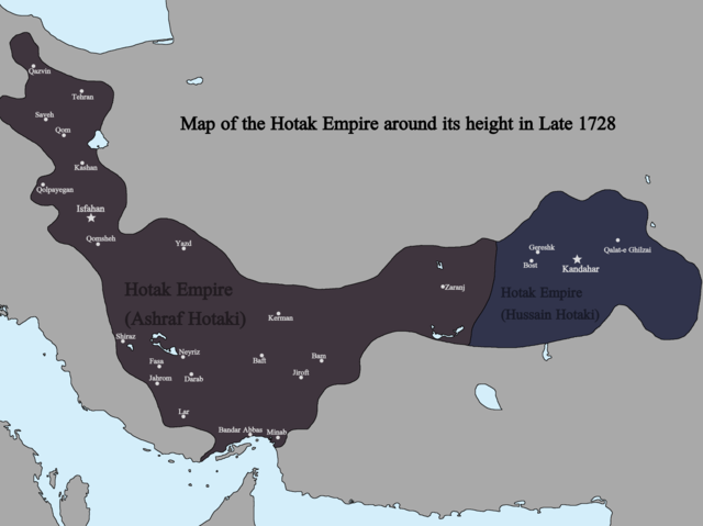
English: Map of the Hotak Empire around late 1728. Sources consulted in the making of this map include:
The Fall of the Safavi Dynasty and the Afghan Occupation of Persia by Laurence Lockhart The Afghan Occupation of Safavid Persia 1721-1729 by Willem Floor Articles from Encyclopedia Iranica History of the Wars 1721-1738 by Abraham of Erevan and translated by George A. Bournoutian The Chronicles of a Traveller: Or, A History of the Afghan Wars with Persia by Tadeusz Judas Krusiński |
| Թվական | |
| Աղբյուր | Բեռնողի սեփական աշխատանք |
| Հեղինակ | Kailanmapper |
Արտոնագրում
Ես, սույն աշխատանքի հեղինակային իրավունքների տերը, այսուհետ այն հրատարակում եմ հետևյալ արտոնագրի ներքո։
This file is licensed under the Creative Commons Attribution-Share Alike 4.0 International license.
- Դուք ազատ եք՝
- կիսվել ստեղծագործությամբ – պատճենել, տարածել և փոխանցել այս աշխատանքը։
- վերափոխել – ադապտացնել աշխատանքը
- Պահպանելով հետևյալ պայմանները'
- հղում – Դուք պետք է նշեք հեղինակի (իրավատիրոջ) հղումը:
- համանման տարածում – Եթե դուք ձևափոխում եք, փոխակերպում, կամ այս աշխատանքի հիման վրա ստեղծում եք նոր աշխատանք, ապա ձեր ստեղծածը կարող է տարածվել միայն նույն կամ համարժեք թույլատրագրով։
Նիշքի պատմություն
Մատնահարեք օրվան/ժամին՝ նիշքի այդ պահին տեսքը դիտելու համար։
| Օր/Ժամ | Մանրապատկեր | Օբյեկտի չափը | Մասնակից | Մեկնաբանություն | |
|---|---|---|---|---|---|
| ընթացիկ | 01:31, 13 Հուլիսի 2021 | | 3711 × 2774 (284 ԿԲ) | Kailanmapper | First map incorrectly had Golpayegan labeled as Qom |
| 21:45, 12 Հուլիսի 2021 |  | 3711 × 2774 (280 ԿԲ) | Kailanmapper | Uploaded own work with UploadWizard |
Նիշքի օգտագործում
Հետևյալ էջը հղվում է այս նիշքին՝
Նիշքի համընդհանուր օգտագործում
Հետևյալ այլ վիքիները օգտագործում են այս նիշքը՝
- Օգտագործումը bn.wikipedia.org կայքում
- Օգտագործումը de.wikipedia.org կայքում
- Օգտագործումը en.wikipedia.org կայքում
- Օգտագործումը fr.wikipedia.org կայքում
- Օգտագործումը ko.wikipedia.org կայքում
- Օգտագործումը mnw.wikipedia.org կայքում
- Օգտագործումը pl.wikipedia.org կայքում
- Օգտագործումը tr.wikipedia.org կայքում
- Օգտագործումը uz.wikipedia.org կայքում