
Պատկեր:Malay language Spoken Area Map v1.png
Ավելի բարձր կետաչափով տարբերակ չկա։
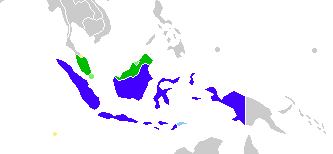
Malay_language_Spoken_Area_Map_v1.png (333 × 154 փիքսել, նիշքի չափը՝ 4 ԿԲ, MIME-տեսակը՝ image/png)
Ամփոփում

|
This linguistic map image could be re-created using vector graphics as an SVG file. This has several advantages; see Commons:Media for cleanup for more information. If an SVG form of this image is available, please upload it and afterwards replace this template with
{{vector version available|new image name}}.
It is recommended to name the SVG file “Malay language Spoken Area Map v1.svg”—then the template Vector version available (or Vva) does not need the new image name parameter. |
| Նկարագրում |
English: This is crop and edit of a .png export of the image at File:BlankMap-World6.svg. The original author released that image into the public domain for any use. This version is released under the CC-Zero license. |
| Թվական | 13 Փետրվար 2011 (original upload date) |
| Աղբյուր | Transferred from en.wikipedia to Commons by Zscout370 using CommonsHelper. |
| Հեղինակ | True at անգլերեն Վիքիպեդիա |
Արտոնագրում
True at անգլերեն Վիքիպեդիա, սույն աշխատանքի հեղինակային իրավունքների տերը, այսուհետ այն հրատարակում է հետևյալ արտոնագրի պայմաններով՝
| This file is made available under the Creative Commons CC0 1.0 Universal Public Domain Dedication. | |
| The person who associated a work with this deed has dedicated the work to the public domain by waiving all of their rights to the work worldwide under copyright law, including all related and neighboring rights, to the extent allowed by law. You can copy, modify, distribute and perform the work, even for commercial purposes, all without asking permission.
|
Original upload log
The original description page was here. All following user names refer to en.wikipedia.
- 2012-02-20 03:34 Kwamikagami 333×154× (4555 bytes) correct area in Thailand, add Cocos Isl.
- 2012-02-20 03:17 Kwamikagami 333×154× (4570 bytes) Reverted to version as of 23:23, 13 February 2011
- 2011-09-14 23:58 Niduzzi 736×386× (33038 bytes)
- 2011-02-13 23:23 True 333×154× (4570 bytes) This is crop and edit of a .png export of the image at http://en.wikipedia.org/wiki/File:BlankMap-World6.svg. The original author released that image into the public domain for any use. This version is released under the CC-Zero license.
Նիշքի պատմություն
Մատնահարեք օրվան/ժամին՝ նիշքի այդ պահին տեսքը դիտելու համար։
| Օր/Ժամ | Մանրապատկեր | Օբյեկտի չափը | Մասնակից | Մեկնաբանություն | |
|---|---|---|---|---|---|
| ընթացիկ | 08:23, 25 փետրվարի 2022 | | 333 × 154 (4 ԿԲ) | Kwamikagami | no longer a map of where Malay is spoken |
| 05:52, 26 Հոկտեմբերի 2018 |  | 4387 × 1922 (336 ԿԲ) | Bennylin | Edit some colors | |
| 05:40, 26 Հոկտեմբերի 2018 |  | 4300 × 1918 (535 ԿԲ) | Bennylin | Change ugly map with PNG version of File:Maritime South East Asia.svg | |
| 04:51, 21 Հունիսի 2012 |  | 333 × 154 (4 ԿԲ) | File Upload Bot (Magnus Manske) | Transfered from en.wikipedia by User:zscout370 using CommonsHelper |
Նիշքի օգտագործում
Այս նիշքին օգտագործող էջեր չկան։
Նիշքի համընդհանուր օգտագործում
Հետևյալ այլ վիքիները օգտագործում են այս նիշքը՝
- Օգտագործումը ckb.wikipedia.org կայքում
- Օգտագործումը el.wikipedia.org կայքում
- Օգտագործումը en.wikipedia.org կայքում
- Օգտագործումը es.wikipedia.org կայքում
- Օգտագործումը fa.wikipedia.org կայքում
- Օգտագործումը frr.wikipedia.org կայքում
- Օգտագործումը id.wikipedia.org կայքում
- Օգտագործումը incubator.wikimedia.org կայքում
- Օգտագործումը mi.wikipedia.org կայքում
- Օգտագործումը nl.wikipedia.org կայքում
- Օգտագործումը zh.wikipedia.org կայքում