
Պատկեր:KumamotoMapCurrent.png

Նախադիտման չափ՝ 653 × 600 պիքսել։ Այլ թույլտվությաններ: 261 × 240 պիքսել | 523 × 480 պիքսել | 981 × 901 պիքսել.
Սկզբնական նիշք (981 × 901 փիքսել, նիշքի չափը՝ 42 ԿԲ, MIME-տեսակը՝ image/png)
Ամփոփում
| Նկարագրում |
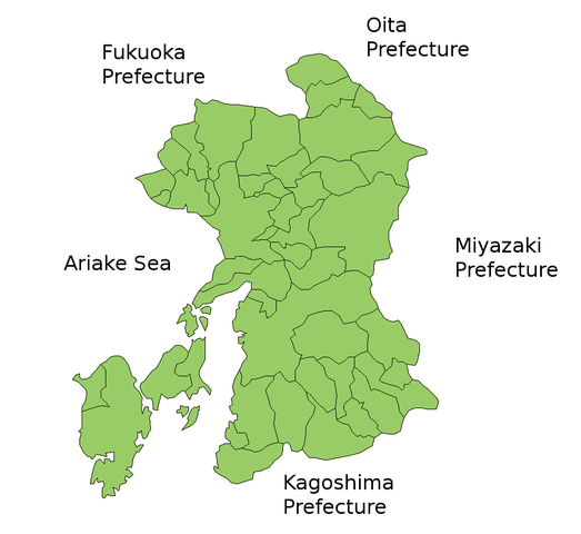
Map of Kumamoto Prefecture, Japan. Thanks to Aoki Shigenobu and [1]. Colors from Image:TokyoMapCurrent.png by User:Fg2. |
| Թվական | 21 Հուլիս 2006 (original upload date) |
| Աղբյուր | No machine-readable source provided. Own work assumed (based on copyright claims). |
| Հեղինակ | No machine-readable author provided. Akanemoto~commonswiki assumed (based on copyright claims). |
Արտոնագրում
| I, the copyright holder of this work, release this work into the public domain. This applies worldwide. In some countries this may not be legally possible; if so: I grant anyone the right to use this work for any purpose, without any conditions, unless such conditions are required by law. |
Նիշքի պատմություն
Մատնահարեք օրվան/ժամին՝ նիշքի այդ պահին տեսքը դիտելու համար։
| Օր/Ժամ | Մանրապատկեր | Օբյեկտի չափը | Մասնակից | Մեկնաբանություն | |
|---|---|---|---|---|---|
| ընթացիկ | 03:08, 23 Մարտի 2010 | | 981 × 901 (42 ԿԲ) | Alberth2 | Ueki Town and Jōnan Town were merged into Kumamoto City. |
| 15:57, 15 Դեկտեմբերի 2008 |  | 981 × 901 (42 ԿԲ) | Alberth2 | Update | |
| 15:56, 15 Դեկտեմբերի 2008 |  | 981 × 901 (42 ԿԲ) | Alberth2 | Update | |
| 15:55, 15 Դեկտեմբերի 2008 |  | 981 × 901 (42 ԿԲ) | Alberth2 | Update | |
| 20:54, 29 Հուլիսի 2006 |  | 981 × 901 (41 ԿԲ) | Akanemoto~commonswiki | ||
| 20:53, 29 Հուլիսի 2006 |  | 981 × 901 (41 ԿԲ) | Akanemoto~commonswiki | fix borders | |
| 23:58, 23 Հուլիսի 2006 |  | 981 × 901 (41 ԿԲ) | Akanemoto~commonswiki | ||
| 15:47, 22 Հուլիսի 2006 |  | 981 × 901 (40 ԿԲ) | Akanemoto~commonswiki | ||
| 02:00, 22 Հուլիսի 2006 |  | 981 × 901 (40 ԿԲ) | Akanemoto~commonswiki | ||
| 21:23, 21 Հուլիսի 2006 |  | 981 × 901 (40 ԿԲ) | Akanemoto~commonswiki | Map of Kumamoto Prefecture, Japan. Thanks to Aoki Shigenobu and [http://aoki2.si.gunma-u.ac.jp/map/map.html]. Colors from Image:TokyoMapCurrent.png by User:Fg2. Category:Maps of Kumamoto prefecture Category:Maps in English |
Նիշքի օգտագործում
Այս նիշքին օգտագործող էջեր չկան։
Նիշքի համընդհանուր օգտագործում
Հետևյալ այլ վիքիները օգտագործում են այս նիշքը՝
- Օգտագործումը be.wikipedia.org կայքում
- Օգտագործումը ckb.wikipedia.org կայքում
- Օգտագործումը cs.wikipedia.org կայքում
- Օգտագործումը fa.wikipedia.org կայքում
- Օգտագործումը incubator.wikimedia.org կայքում
- Օգտագործումը lt.wikipedia.org կայքում
- Օգտագործումը no.wikipedia.org կայքում
- Օգտագործումը pam.wikipedia.org կայքում
- Օգտագործումը pl.wikipedia.org կայքում
- Օգտագործումը ru.wikipedia.org կայքում
- Օգտագործումը vi.wikipedia.org կայքում
- Օգտագործումը www.wikidata.org կայքում