
Պատկեր:Carthage, Tunisia EO-1.jpg
Նախադիտման չափ՝ 600 × 600 պիքսել։ Այլ թույլտվությաններ: 240 × 240 պիքսել | 480 × 480 պիքսել | 768 × 768 պիքսել | 1024 × 1024 պիքսել | 2048 × 2048 պիքսել | 3000 × 3000 պիքսել.
Սկզբնական նիշք (3000 × 3000 փիքսել, նիշքի չափը՝ 3,37 ՄԲ, MIME-տեսակը՝ image/jpeg)
Ամփոփում
| Նկարագրում |
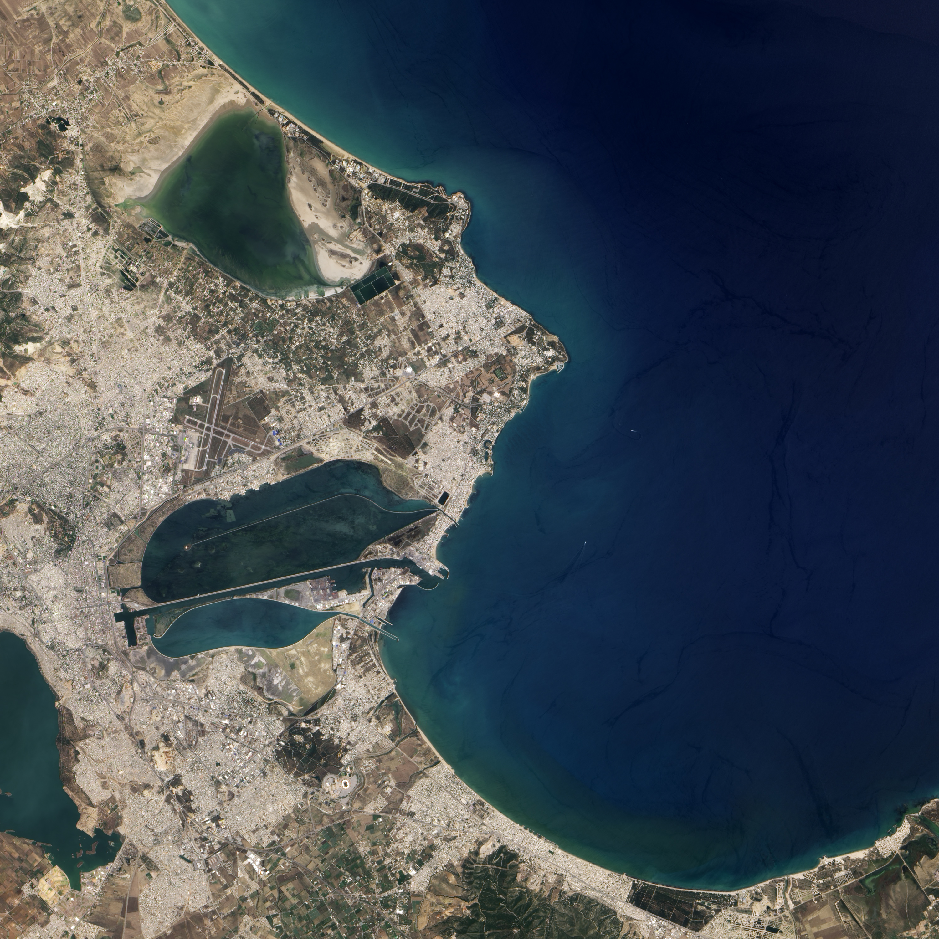
English: Natural-colour image of Carthage on June 24, 2004. In the east, Carthage narrows to a point that stretches into the Gulf of Tunis. From that point, skinny strips of land extend toward the north-west and south-west, both strips enclosing water bodies. North of Carthage is Sebkhet Arina, a shallow evaporative lake. Rocky outcrops connected by sand separate this shallow lake from the Gulf of Tunis. South of Carthage is Lake Tunis, a water body actively modified and maintained by humans over thousands of years. |
| Թվական | |
| Աղբյուր | NASA Earth Observatory |
| Հեղինակ | Jesse Allen |
Image captured by the Advanced Land Imager (ALI) on NASA’s Earth Observing-1 (EO-1) satellite. EO-1 ALI data provided courtesy of the NASA EO-1 team.
Արտոնագրում
| Այս նիշքը հանրության սեփականության է պատկանում, քանզի այն ստեղծվել է ՆԱՍԱ-ն։ ՆԱՍԱ-ի հեղինակային իրավունքների մասին քաղաքականությունը նշում է, որ «ՆԱՍԱ-ի նյութերը հեղինակային իրավունքներով պաշտպանված չեն, միթե այդպես նշված լինի»։ (Տե՛ս Template:PD-USGov, ՆԱՍԱ-ի հեղինակային իրավունքների քաղաքականության մասին էջը կամ ՋեյՓիԷլի պատկերների օգտագործման մասին քաղաքականությունը)։ | ||
 |
Զգուշացումներ՝:
|
| Annotations | This image is annotated: View the annotations at Commons |
Նիշքի պատմություն
Մատնահարեք օրվան/ժամին՝ նիշքի այդ պահին տեսքը դիտելու համար։
| Օր/Ժամ | Մանրապատկեր | Օբյեկտի չափը | Մասնակից | Մեկնաբանություն | |
|---|---|---|---|---|---|
| ընթացիկ | 12:40, 16 Օգոստոսի 2010 | | 3000 × 3000 (3,37 ՄԲ) | Originalwana | {{Information |Description={{en|1=Natural-colour image of Carthage on June 24, 2004. In the east, Carthage narrows to a point that stretches into the Gulf of Tunis. From that point, skinny strips of land extend toward the north |
Նիշքի օգտագործում
Հետևյալ էջը հղվում է այս նիշքին՝
Նիշքի համընդհանուր օգտագործում
Հետևյալ այլ վիքիները օգտագործում են այս նիշքը՝