
Պատկեր:Al-idrisi world map.jpg
Սկզբնական նիշք (6828 × 5068 փիքսել, նիշքի չափը՝ 11,05 ՄԲ, MIME-տեսակը՝ image/jpeg)
Ամփոփում
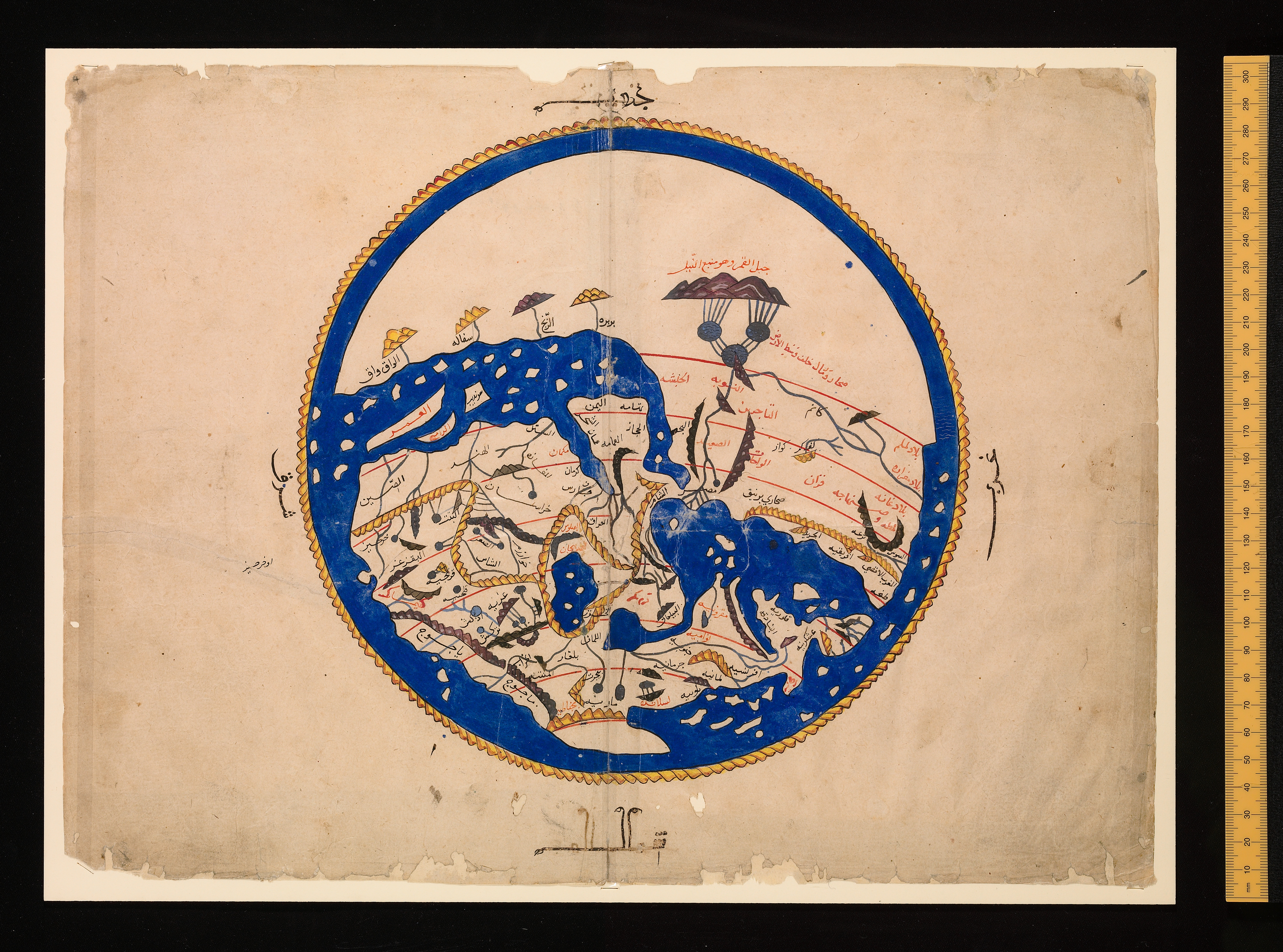
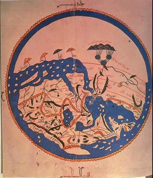
- en:al-Idrisi world map, Arabic from 804/1154/1456 A.D.
- Oriented with South at the top
- Public domain because of age.
First version taken from [1] archive copy at the Wayback Machine, more specifically [2] archive copy at the Wayback Machine. Second version was losslessly rotaded from [3]
Versions
-
 This version (original).
 -
 Cropped.
 -
 More cropped.


![[2]](http://www.henry-davis.com/MAPS/EMimages/219.JPG)
![[3]](https://www.sindominio.net/labiblio/varios/IdrisiMap.jpg)
Արտոնագրում
|
Այս պատկերում գտնվող երկչափ ստեղծագործությունը հանրության սեփականություն է ամբողջ աշխարհում հեղինակի մահվան ժամանակի, կամ առաջի հրատարակման պատճառով:
Այսպիսով, տվյալ վերարտադրումը նույնպես հանրության սեփականություն է: Դա վերաբերվում է ԱՄՆ-ում, Գերմանիայում և ուրիշ բազմաթիվ պետություններում ստեղծված երկերին: {{PD-Art}} template without license parameter: please specify why the underlying work is public domain in both the source country and the United States
(Usage: {{PD-Art|1=|deathyear=''year of author's death''|country=''source country''}}, where parameter #1 can be PD-old-auto, PD-old-auto-expired, PD-old-auto-1996, PD-old-100 or similar. See Commons:Multi-license copyright tags for more information.) | ||||
Նիշքի պատմություն
Մատնահարեք օրվան/ժամին՝ նիշքի այդ պահին տեսքը դիտելու համար։
| Օր/Ժամ | Մանրապատկեր | Օբյեկտի չափը | Մասնակից | Մեկնաբանություն | |
|---|---|---|---|---|---|
| ընթացիկ | 09:50, 12 Սեպտեմբերի 2022 | | 6828 × 5068 (11,05 ՄԲ) | Mike Krüger | Original Map from https://digital.bodleian.ox.ac.uk/objects/ced0d8bd-1019-4af2-9086-e411115f1507/surfaces/cc2debab-70f5-4b82-9bab-7235fdb89e43/ |
| 12:21, 23 Օգոստոսի 2006 |  | 1765 × 1578 (1,08 ՄԲ) | Leinad-Z~commonswiki | Losslessly rotaded from http://www.sindominio.net/labiblio/varios/IdrisiMap.jpg | |
| 12:57, 5 Ապրիլի 2005 |  | 492 × 570 (72 ԿԲ) | Dittaeva | * en:al-Idrisi world map, Arabic from 804/1154/1456 A.D. * Oriented with South at the top * Taken from [http://www.henry-davis.com/MAPS/EMwebpages/219.html], more specifically [http://www.henry-davis.com/MAPS/EMimages/219.JPG]. * Public domain be |
Նիշքի օգտագործում
Հետևյալ էջը հղվում է այս նիշքին՝
Նիշքի համընդհանուր օգտագործում
Հետևյալ այլ վիքիները օգտագործում են այս նիշքը՝
- Օգտագործումը ba.wikipedia.org կայքում
- Օգտագործումը de.wikipedia.org կայքում
- Օգտագործումը el.wikipedia.org կայքում
- Օգտագործումը en.wikipedia.org կայքում
- Օգտագործումը fi.wikipedia.org կայքում
- Օգտագործումը it.wikipedia.org կայքում
- Օգտագործումը ka.wikipedia.org կայքում
- Օգտագործումը lt.wikipedia.org կայքում
- Օգտագործումը ru.wikipedia.org կայքում
- Օգտագործումը tg.wikipedia.org կայքում
- Օգտագործումը uk.wikipedia.org կայքում