
Պատկեր:LocationRomanEmpire.png
Նախադիտման չափ՝ 800 × 520 պիքսել։ Այլ թույլտվությաններ: 320 × 208 պիքսել | 640 × 416 պիքսել | 1084 × 705 պիքսել.
Սկզբնական նիշք (1084 × 705 փիքսել, նիշքի չափը՝ 34 ԿԲ, MIME-տեսակը՝ image/png)

|
Please translate the English parts of this template into Armenian.
Գոյություն ունի այս պատկերի վեկտորային տարբերակը ("SVG"): Եթե այն իր ռաստրային տարբերակից ավելի որակյալ է, ապա գերադասելի է նրա օգտագործումը: File:LocationRomanEmpire.png → File:Map of the Roman Empire at its height.svg
Վեկտորային գրաֆիկայի մասին ավելին իմանալու համար կարող եք կարդալ պատկերների փոխադրման մասին SVG ֆորմատի: Նաև մատչելի են տեղեկություններ SVG ֆորմատի աջակցման մասին ՄեդիաՎիքիյում: |
 |
| Նկարագրում |
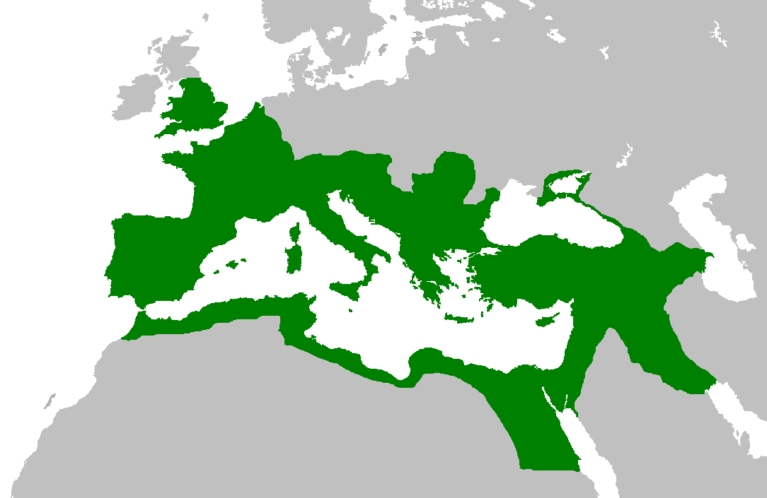
English: Map of the Roman Empire at its height, under Trajan.
Esperanto: Mapo de la Roma Imperio je ĝia plej vasta etendo, sub la imperiestro Trajano.
Español: El Imperio Romano a su máxima extensión, durante el reinado de Trajano.
Suomi: Rooman valtakunta Trajanuksen aikana.
Français : L'Empire romain à son apogée, sous Trajan.
Italiano: Mappa dell'Impero Romano al culmine della sua estensione, sotto Traiano.
日本語: 117年(トラヤヌス帝の時代)のローマ帝国の最大領土
Português: Localização do Império Romano em sua extensão máxima. |
||||||||
| Թվական | |||||||||
| Աղբյուր | Previous version | ||||||||
| Հեղինակ | User:Jrockley / User:Kasper Holl | ||||||||
| Իրավունքներ (Նիշքի վերաօգտագործումը) |
|
||||||||
| Այլ մեկնակերպներ |
|

Նիշքի պատմություն
Մատնահարեք օրվան/ժամին՝ նիշքի այդ պահին տեսքը դիտելու համար։
| Օր/Ժամ | Մանրապատկեր | Օբյեկտի չափը | Մասնակից | Մեկնաբանություն | |
|---|---|---|---|---|---|
| ընթացիկ | 14:44, 2 Հունիսի 2007 | | 1084 × 705 (34 ԿԲ) | Medievalista | Ok, sorry, my mistake... here is the new map |
| 14:42, 2 Հունիսի 2007 |  | 1084 × 705 (34 ԿԲ) | Medievalista | Update of the previous map: less of teritory in Africa, withdraw in Britain up to the future Hadrianic wall and improve the trace of the Rhine-Danube frontier | |
| 03:45, 5 փետրվարի 2007 |  | 1084 × 705 (35 ԿԲ) | Jrockley | lil bit more Africa, lil less Scandinavia | |
| 03:28, 5 փետրվարի 2007 |  | 1259 × 756 (41 ԿԲ) | Jrockley | Much larger version, as faithful as possible | |
| 12:24, 9 Օգոստոսի 2005 |  | 250 × 175 (8 ԿԲ) | Kasper Holl | Map of the location of the Roman Empire at its height, under Trajan. Made from the Blank Map World. |
Նիշքի օգտագործում
Հետևյալ էջը հղվում է այս նիշքին՝
Նիշքի համընդհանուր օգտագործում
Հետևյալ այլ վիքիները օգտագործում են այս նիշքը՝
- Օգտագործումը en.wikipedia.org կայքում
- Օգտագործումը he.wikipedia.org կայքում
- Օգտագործումը it.wikipedia.org կայքում
- Օգտագործումը kk.wikipedia.org կայքում