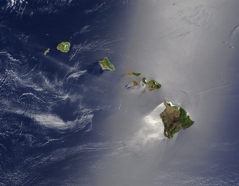
Պատկեր:Hawaje.jpg

Նախադիտման չափ՝ 771 × 600 պիքսել։ Այլ թույլտվությաններ: 309 × 240 պիքսել | 617 × 480 պիքսել | 988 × 768 պիքսել | 1280 × 996 պիքսել | 2560 × 1991 պիքսել | 3600 × 2800 պիքսել.
Սկզբնական նիշք (3600 × 2800 փիքսել, նիշքի չափը՝ 1,16 ՄԲ, MIME-տեսակը՝ image/jpeg)
Նիշքի պատմություն
Մատնահարեք օրվան/ժամին՝ նիշքի այդ պահին տեսքը դիտելու համար։
| Օր/Ժամ | Մանրապատկեր | Օբյեկտի չափը | Մասնակից | Մեկնաբանություն | |
|---|---|---|---|---|---|
| ընթացիկ | 18:19, 26 Հոկտեմբերի 2005 |  | 3600 × 2800 (1,16 ՄԲ) | Palladinus | Hawaii Islands |
Նիշքի օգտագործում
Այս նիշքին օգտագործող էջեր չկան։
Նիշքի համընդհանուր օգտագործում
Հետևյալ այլ վիքիները օգտագործում են այս նիշքը՝
- Օգտագործումը arz.wikipedia.org կայքում
- Օգտագործումը bg.wikipedia.org կայքում
- Օգտագործումը ceb.wikipedia.org կայքում
- Օգտագործումը co.wikipedia.org կայքում
- Օգտագործումը en.wikipedia.org կայքում
- Օգտագործումը es.wikipedia.org կայքում
- Օգտագործումը fr.wikipedia.org կայքում
- Օգտագործումը fr.wiktionary.org կայքում
- Օգտագործումը gcr.wikipedia.org կայքում
- Օգտագործումը gl.wikipedia.org կայքում
- Օգտագործումը hr.wikipedia.org կայքում
- Օգտագործումը ky.wikipedia.org կայքում
- Օգտագործումը lv.wikipedia.org կայքում
- Օգտագործումը no.wikipedia.org կայքում
- Օգտագործումը oc.wikipedia.org կայքում
- Օգտագործումը pdc.wikipedia.org կայքում
- Օգտագործումը pl.wikipedia.org կայքում
- Օգտագործումը pl.wiktionary.org կայքում
- Օգտագործումը ro.wikipedia.org կայքում
- Օգտագործումը ru.wikipedia.org կայքում
- Օգտագործումը ru.wikinews.org կայքում
- Օգտագործումը sq.wikipedia.org կայքում
- Օգտագործումը sw.wikipedia.org կայքում
- Օգտագործումը to.wikipedia.org կայքում
- Օգտագործումը uk.wikipedia.org կայքում


