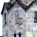
Պատկեր:The Holy Trinity Church, Malatia-Sebastia district, Yerevan, Armenia, Entity Sign E.jpg

Page contents not supported in other languages.
Վիքիպեդիայից՝ ազատ հանրագիտարանից

The_Holy_Trinity_Church,_Malatia-Sebastia_district,_Yerevan,_Armenia,_Entity_Sign_E.jpg(320 × 320 փիքսել, նիշքի չափը՝ 138 ԿԲ, MIME-տեսակը՝ image/jpeg)

Այս նիշքը տեղադրված է Վիքիպահեստում է և այն կարող է օգտագործվել այլ նախագծերի կողմից։ Վիքիպահեստում նիշքի մասին տեղեկությունների հիմնական մասը ներկայացված է ստորև։

Ամփոփում

Նկարագրում
English: The Holy Trinity Church, Malatia-Sebastia district, Yerevan, Armenia, the Entity Sign E on the wall of bell tower
Թվական
Աղբյուր File:The_Holy_Trinity_Church,_Malatia-Sebastia_district,_Yerevan,_Armenia.jpg
Հեղինակ Anna Rogozhina
Իրավունքներ
(Նիշքի վերաօգտագործումը)

On the page of File:The_Holy_Trinity_Church,_Malatia-Sebastia_district,_Yerevan,_Armenia.jpg

This image, which was originally posted to Flickr, was uploaded to Commons using Flickr upload bot on 24 Հունիս 2009, 04:55 by Serouj. On that date, it was confirmed to be licensed under the terms of the license indicated.
w:en:Creative Commons
հղում
This file is licensed under the Creative Commons Attribution 2.0 Generic license.
Դուք ազատ եք՝
  • կիսվել ստեղծագործությամբ – պատճենել, տարածել և փոխանցել այս աշխատանքը։
  • վերափոխել – ադապտացնել աշխատանքը
Պահպանելով հետևյալ պայմանները'
  • հղում – Դուք պետք է նշեք հեղինակի (իրավատիրոջ) հղումը:

Armenia

According to article 25 of the Armenian Law on Copyright and Related Rights it shall be lawful to reproduce or to communicate to the public, without authorization of the author and without remuneration, a work of architecture or the fine arts, a work of applied arts or a photographic work that is situated on streets, parks, squares and other places open for attendance. See COM:CRT/Armenia#Freedom of panorama for more information.

English | français | русский | 中文 | +/−

Այլ մեկնակերպներ File:The_Holy_Trinity_Church,_Malatia-Sebastia_district,_Yerevan,_Armenia.jpg
Տեսախցիկի տեղագրություն40° 10′ 26,17″ Հս. լ., 44° 26′ 29,28″ Աե. ե. Kartographer map based on OpenStreetMap.Այս և ուրիշ պատկերներ իրենց տեղագրությամբ OpenStreetMapinfo

Արտոնագրում

Annotations
InfoField
This image is annotated: View the annotations at Commons

Captions

Add a one-line explanation of what this file represents

28 Հոկտեմբերի 2007

Նիշքի պատմություն

Մատնահարեք օրվան/ժամին՝ նիշքի այդ պահին տեսքը դիտելու համար։

Օր/ԺամՄանրապատկերՕբյեկտի չափըՄասնակիցՄեկնաբանություն
ընթացիկ18:21, 16 Օգոստոսի 201318:21, 16 Օգոստոսի 2013 տարբերակի մանրապատկերը320 × 320 (138 ԿԲ)Vahram MekhitarianUser created page with UploadWizard

Հետևյալ էջը հղվում է այս նիշքին՝

Նիշքի համընդհանուր օգտագործում

Հետևյալ այլ վիքիները օգտագործում են այս նիշքը՝

Մետատվյալներ