
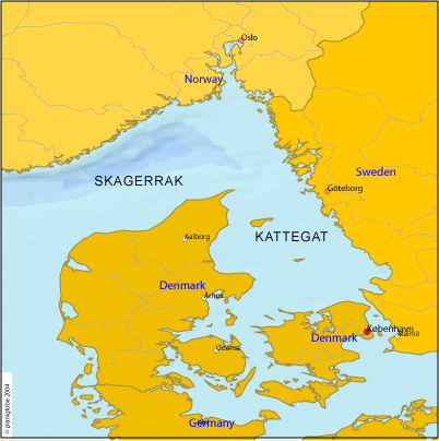
Պատկեր:Skagerrak-Kattegat.png
Ավելի բարձր կետաչափով տարբերակ չկա։
Skagerrak-Kattegat.png (402 × 404 փիքսել, նիշքի չափը՝ 88 ԿԲ, MIME-տեսակը՝ image/png)
Ամփոփում
- Outlets of the Baltic Sea to the Atlantic.
- Credits
- Source: http://www.planiglobe.com
Արտոնագրում
| This image is from Planiglobe. All maps hosted on Planiglobe are licensed under the Creative Commons Attribution 2.5 License, but Planiglobe suggests that they not be used for navigational purposes. For the purposes of this license, this clause is considered a disclaimer and not a license restriction. This file is licensed under the Creative Commons Attribution 2.5 Generic license.
|
Նիշքի պատմություն
Մատնահարեք օրվան/ժամին՝ նիշքի այդ պահին տեսքը դիտելու համար։
| Օր/Ժամ | Մանրապատկեր | Օբյեկտի չափը | Մասնակից | Մեկնաբանություն | |
|---|---|---|---|---|---|
| ընթացիկ | 08:57, 8 Հոկտեմբերի 2005 | | 402 × 404 (88 ԿԲ) | ToB | '''The North Sea''' (Skagerrak and Kattegat, the sea area between Norway, Sweden and Denmark) :'''Source:''' http://www.planiglobe.com Category:Maps of seas |
Նիշքի օգտագործում
Նիշքի համընդհանուր օգտագործում
Հետևյալ այլ վիքիները օգտագործում են այս նիշքը՝
- Օգտագործումը az.wikipedia.org կայքում
- Օգտագործումը ba.wikipedia.org կայքում
- Օգտագործումը de.wiktionary.org կայքում
- Օգտագործումը et.wikipedia.org կայքում
- Օգտագործումը gd.wikipedia.org կայքում
- Օգտագործումը kk.wikipedia.org կայքում
- Օգտագործումը ru.wikipedia.org կայքում
- Օգտագործումը simple.wikipedia.org կայքում
- Օգտագործումը sr.wikipedia.org կայքում
- Օգտագործումը tt.wikipedia.org կայքում