
Պատկեր:Perspective view of makai elevation, looking ewa-mauka - Washington Place, 320 South Beretania Street, Honolulu, Honolulu County, HI HABS HI,2-HONLU,28-40.tif

Size of this JPG preview of this TIF file: 800 × 578 պիքսել. Այլ թույլտվությաններ: 320 × 231 պիքսել | 640 × 463 պիքսել | 1024 × 740 պիքսել | 1280 × 925 պիքսել | 2560 × 1851 պիքսել | 5320 × 3846 պիքսել.
Սկզբնական նիշք (5320 × 3846 փիքսել, նիշքի չափը՝ 19,52 ՄԲ, MIME-տեսակը՝ image/tiff)
Ամփոփում
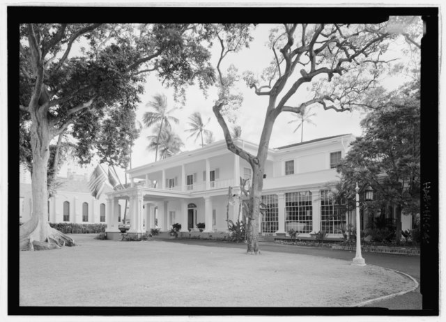
| Perspective view of makai elevation, looking ewa-mauka - Washington Place, 320 South Beretania Street, Honolulu, Honolulu County, HI | ||||
|---|---|---|---|---|
| Լուսանկարիչ |
Rosenthal, James W. Related names:
|
|||
| Title |
Perspective view of makai elevation, looking ewa-mauka - Washington Place, 320 South Beretania Street, Honolulu, Honolulu County, HI |
|||
| Depicted place | Hawaii; Honolulu County; Honolulu | |||
| Թվական | 2007 | |||
| Չափեր | 5 x 7 in. | |||
| Ընթացիկ տեղագրություն |
Library of Congress Prints and Photographs Division Washington, D.C. 20540 USA http://hdl.loc.gov/loc.pnp/pp.print |
|||
| ID |
HABS HI,2-HONLU,28-40 |
|||
| Credit line |
|
|||
| Ծանոթագրություններ |
|
|||
| References |
|
|||
| Աղբյուր | https://www.loc.gov/pictures/item/hi0023.photos.225498p | |||
| Իրավունքներ (Նիշքի վերաօգտագործումը) |
|
|||

| Տեսախցիկի տեղագրություն | | Այս և ուրիշ պատկերներ իրենց տեղագրությամբ OpenStreetMap |
|---|
Նիշքի պատմություն
Մատնահարեք օրվան/ժամին՝ նիշքի այդ պահին տեսքը դիտելու համար։
| Օր/Ժամ | Մանրապատկեր | Օբյեկտի չափը | Մասնակից | Մեկնաբանություն | |
|---|---|---|---|---|---|
| ընթացիկ | 17:23, 15 Հուլիսի 2014 |  | 5320 × 3846 (19,52 ՄԲ) | Fæ | GWToolset: Creating mediafile for Fæ. HABS 09 July 2014 (801:1000) |
Նիշքի օգտագործում
Հետևյալ էջը հղվում է այս նիշքին՝