
Պատկեր:Mid-ocean ridge system.gif

Նախադիտման չափ՝ 800 × 487 պիքսել։ Այլ թույլտվությաններ: 320 × 195 պիքսել | 640 × 389 պիքսել | 1152 × 701 պիքսել.
Սկզբնական նիշք (1152 × 701 փիքսել, նիշքի չափը՝ 500 ԿԲ, MIME-տեսակը՝ image/gif)
Ամփոփում
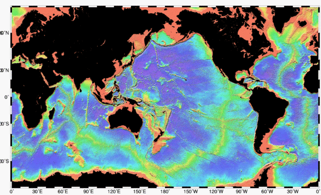
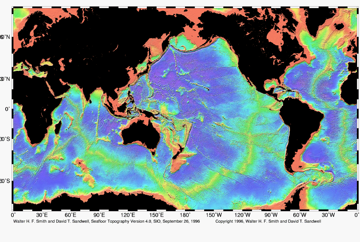
| Նկարագրում | Map of the mid-ocean ridge system (yellow-green) in the Earth’s oceans. |
| Թվական | |
| Աղբյուր | http://www.ngdc.noaa.gov/mgg/image/global_topo_large.gif |
| Հեղինակ | National Oceanic and Atmospheric Administration |
Արտոնագրում
This image is in the public domain because it contains materials that originally came from the U.S. National Oceanic and Atmospheric Administration, taken or made as part of an employee's official duties.
|
Նիշքի պատմություն
Մատնահարեք օրվան/ժամին՝ նիշքի այդ պահին տեսքը դիտելու համար։
| Օր/Ժամ | Մանրապատկեր | Օբյեկտի չափը | Մասնակից | Մեկնաբանություն | |
|---|---|---|---|---|---|
| ընթացիկ | 02:48, 1 Մայիսի 2010 | | 1152 × 701 (500 ԿԲ) | Adrignola | {{Information |Description=Map of the mid-ocean ridge system (yellow-green) in the Earth’s oceans. |Source=http://www.ngdc.noaa.gov/mgg/image/global_topo_large.gif |Date=1996-09-26 |Author=w:National Oceanic and Atmospheric Administration |Permissi |
Նիշքի օգտագործում
Հետևյալ էջը հղվում է այս նիշքին՝
Նիշքի համընդհանուր օգտագործում
Հետևյալ այլ վիքիները օգտագործում են այս նիշքը՝
- Օգտագործումը ban.wikipedia.org կայքում
- Օգտագործումը en.wikipedia.org կայքում
- Օգտագործումը en.wikibooks.org կայքում
- Օգտագործումը en.wiktionary.org կայքում
- Օգտագործումը es.wikibooks.org կայքում
- Օգտագործումը id.wikipedia.org կայքում
- Օգտագործումը ko.wikipedia.org կայքում
- Օգտագործումը ru.wikipedia.org կայքում
- Օգտագործումը tw.wikipedia.org կայքում