Պատկեր:Illyrians (English).svg

Page contents not supported in other languages.
Վիքիպեդիայից՝ ազատ հանրագիտարանից

Սկզբնական նիշք(SVG-նիշք, անվանապես 1600 × 1600 փիքսել, նիշքի չափը՝ 5,11 ՄԲ)

Այս նիշքը տեղադրված է Վիքիպահեստում է և այն կարող է օգտագործվել այլ նախագծերի կողմից։ Վիքիպահեստում նիշքի մասին տեղեկությունների հիմնական մասը ներկայացված է ստորև։

Ամփոփում

Նկարագրում
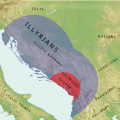
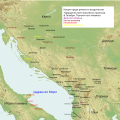
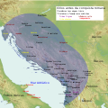
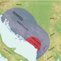
English: Simple Map of Illyrians, Illyria Barbara, Illyria Graeca, Illyrians Proper and Environs
  • carte des tribus illyriennes
  • illyrische Stamme Karte
  • Mappa di tribu illiriche
  • mapa de tribos ilirias
  • Mapa Ilirske plemena
  • mapa de las tribus de Illyrian
  • Fiset ilire harte
  • Χάρτης Ιλλυριών φυλών
  • Карта из иллирийских племен
  • Мапа илирског племена
Թվական
Աղբյուր Բեռնողի սեփական աշխատանք
Հեղինակ MaryroseB54
Այլ մեկնակերպներ

[խմբագրել]

v1
v2
v3
v4
  • The central Balkan tribes in pre-Roman times: Triballi, Autariatae, Dardanians, Scordisci and Moesians by Fanula Papazoglu,1978,ISBN -9025607934
  • The Cambridge Ancient History, Volume 6: The Fourth Century BC by D. M. Lewis (Editor), John Boardman (Editor), Simon Hornblower (Editor), M. Ostwald (Editor),1994,ISBN 0521233488
  • The Cambridge Ancient History, Vol. 10: The Augustan Empire, 43 BC-AD 69 (Volume 10) by Alan Bowman, Edward Champlin, and Andrew Lintott,1996
  • Pannonia and Upper Moesia. A History of the Middle Danube Provinces of the Roman Empire. A Mocsy, S Frere
  • Dalmatia Tome 2 of History of the provinces of the Roman Empire by J. J. Wilkes,1969
  • Wilkes, J. J. The Illyrians, 1992,ISBN 0631198075,
  • Hammond, N. G. L. A History of Greece to 322 B.C., 1986, ISBN-10: 0198730950
  • The Loeb Editor's Notes, 28 Nova Epirus or Illyris Graeca (Epirus, Nova Illyria Graeca) "Nova Epirus or Illyris Graeca extended from the Drilo (Mod. Drina) River on the north to the Ceraunian Mts. on the south, thus comprising a large part of modern Albania. Immediately to the south of it to the Ambracian Gulf (Mod. Gulf of Arta) lay what is here called Old Epirus, approximately identical with the Epirus of modern Greece."
  • Blank map,File:Yugoslavia_topographic_base_map.svg

Արտոնագրում

Ես, սույն աշխատանքի հեղինակային իրավունքների տերը, այսուհետ այն հրատարակում եմ հետևյալ արտոնագրի ներքո։
w:en:Creative Commons
հղում համանման տարածում
This file is licensed under the Creative Commons Attribution-Share Alike 4.0 International license.
Դուք ազատ եք՝
  • կիսվել ստեղծագործությամբ – պատճենել, տարածել և փոխանցել այս աշխատանքը։
  • վերափոխել – ադապտացնել աշխատանքը
Պահպանելով հետևյալ պայմանները'
  • հղում – Դուք պետք է նշեք հեղինակի (իրավատիրոջ) հղումը:
  • համանման տարածում – Եթե դուք ձևափոխում եք, փոխակերպում, կամ այս աշխատանքի հիման վրա ստեղծում եք նոր աշխատանք, ապա ձեր ստեղծածը կարող է տարածվել միայն նույն կամ համարժեք թույլատրագրով։
Translate this file

Այս SVG ֆայլ օգտագործում է զետեղված տեքստ, որը կարելի է հեշտ թարգմանել ձեր լեզվի վրա using [toolforge:svgtranslate/File:Illyrians_(English).svglink this automated tool]: Իմացեք ավելին: You can also download it and translate it manually using a text editor.

Annotations
InfoField
This image is annotated: View the annotations at Commons

Captions

Add a one-line explanation of what this file represents

Items portrayed in this file

պատկերված

19 Հունիսի 2016

Նիշքի պատմություն

Մատնահարեք օրվան/ժամին՝ նիշքի այդ պահին տեսքը դիտելու համար։

Օր/ԺամՄանրապատկերՕբյեկտի չափըՄասնակիցՄեկնաբանություն
ընթացիկ12:56, 23 Հունիսի 201612:56, 23 Հունիսի 2016 տարբերակի մանրապատկերը1600 × 1600 (5,11 ՄԲ)MaryroseB54User created page with UploadWizard

Հետևյալ 2 էջերը հղվում են այս նիշքին՝

Նիշքի համընդհանուր օգտագործում

Հետևյալ այլ վիքիները օգտագործում են այս նիշքը՝

Մետատվյալներ