
Պատկեր:Haryana locator map.svg

Size of this PNG preview of this SVG file: 481 × 599 պիքսել. Այլ թույլտվությաններ: 193 × 240 պիքսել | 385 × 480 պիքսել | 617 × 768 պիքսել | 822 × 1024 պիքսել | 1645 × 2048 պիքսել | 954 × 1188 պիքսել.
Սկզբնական նիշք (SVG-նիշք, անվանապես 954 × 1188 փիքսել, նիշքի չափը՝ 83 ԿԲ)
| Անվանում |
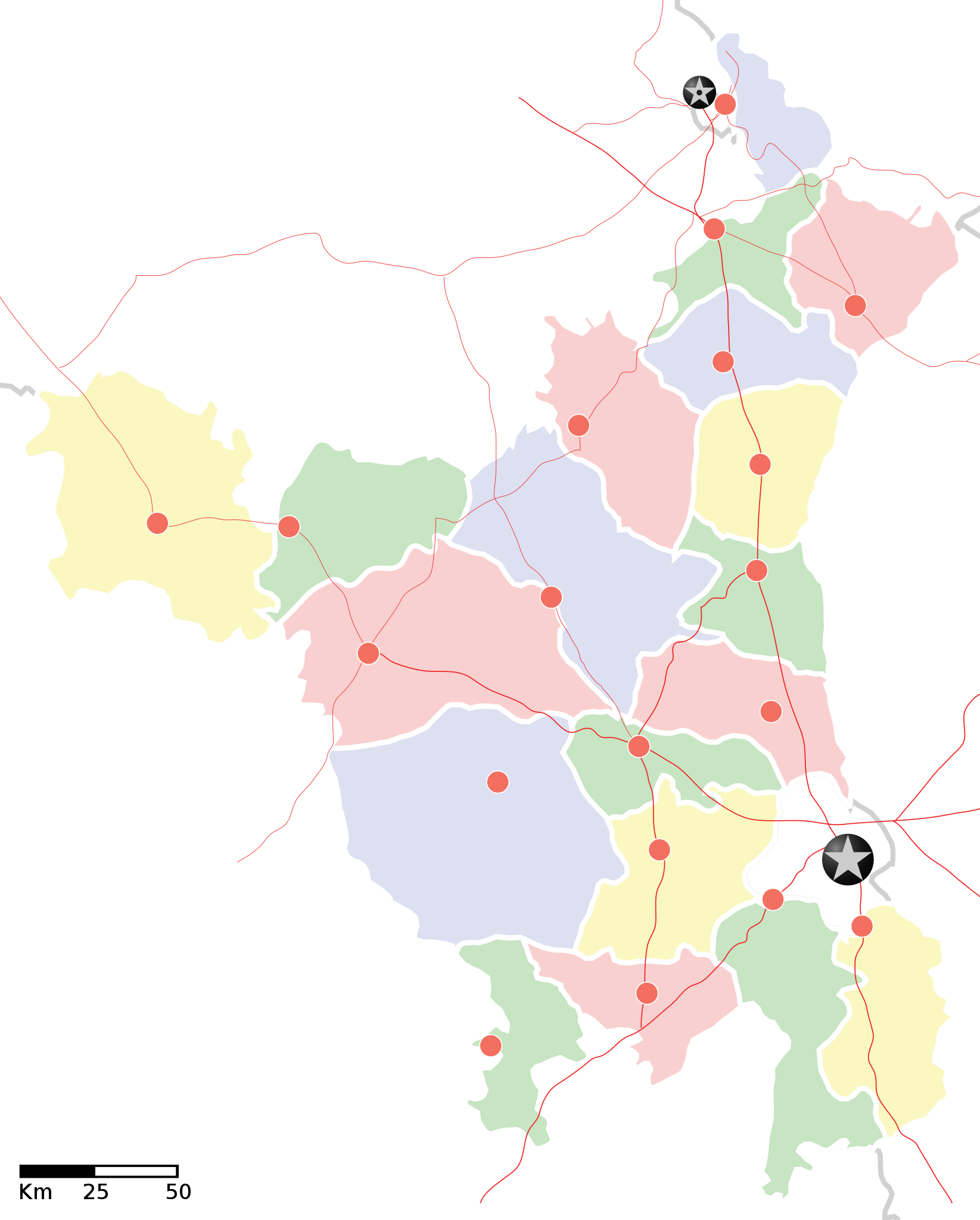
Haryana locator map |
||
| Description |
Locator map of the state of en:Haryana, India with district boundaries. Equirectangular projection. Geographic limits of the map: top=30.975 |
||
| Թվական | |||
| Աղբյուր |
Բեռնողի սեփական աշխատանք |
||
| Ստեղծել է |
|
||
| Իրավունքներ (Նիշքի վերաօգտագործումը) |
Ես, սույն աշխատանքի հեղինակային իրավունքների տերը, այսուհետ այն հրատարակում եմ հետևյալ արտոնագրի ներքո։ Այս նիշքը հասանելի է Creative Commons Attribution-Share Alike 3.0 Unported արտոնագրի ներքո:
|
||
| Geotemporal data | |||
| Պատկերման ամսաթիվ | second half of 20 century և 21 century | ||
| Georeferencing | If inappropriate please set warp_status = skip to hide. | ||
| Archival data | |||
| Ծանոթագրություններ | Part of WikiProject India Maps | ||
![[1]](http://maps.newkerala.com/Haryana-Travel-Map.jpg)
Նիշքի պատմություն
Մատնահարեք օրվան/ժամին՝ նիշքի այդ պահին տեսքը դիտելու համար։
| Օր/Ժամ | Մանրապատկեր | Օբյեկտի չափը | Մասնակից | Մեկնաբանություն | |
|---|---|---|---|---|---|
| ընթացիկ | 17:35, 9 Սեպտեմբերի 2008 | | 954 × 1188 (83 ԿԲ) | Planemad | {{Information |Description= |Source= |Date= |Author= |Permission= |other_versions= }} |
| 17:31, 9 Սեպտեմբերի 2008 |  | 954 × 1188 (83 ԿԲ) | Planemad | {{Information |Description={{en|1=a}} |Source=Own work by uploader |Author=PlaneMad |Date= |Permission= |other_versions= }} <!--{{ImageUpload|full}}--> |
Նիշքի օգտագործում
Այս նիշքին օգտագործող էջեր չկան։
Նիշքի համընդհանուր օգտագործում
Հետևյալ այլ վիքիները օգտագործում են այս նիշքը՝
- Օգտագործումը ar.wikipedia.org կայքում
- Օգտագործումը as.wikipedia.org կայքում
- Օգտագործումը awa.wikipedia.org կայքում
- खाँचा:हरियाणा
- अम्बाला जिला
- करनाल जिला
- कर्ण झील
- कालका
- कुरुक्षेत्र जिला
- कैथल जिला
- गुड़गांव जिला
- गुरुग्राम
- चरखी दादरी
- तेलंगाना कय जिला
- पंचकुला
- पंचकूला
- पानीपत ज़िला
- पानीपत जिला
- पेहवा
- फरीदाबाद
- बड़खल झील
- मोरनी हिल्स
- रोहतक
- लोकसभा चुनाव क्षेत्रन कय सूची
- सोनीपत जिला
- हरियाणा विधानसभा
- हिसार
- खाँचा:तेलंगाना कय जिला
- खाँचा:हरियाणा कय लोकसभा चुनाव क्षेत्र
- खाँचा:हरियाणा कय विधानसभा चुनाव क्षेत्र
- Օգտագործումը ba.wikipedia.org կայքում
- Օգտագործումը bo.wikipedia.org կայքում
- Օգտագործումը ceb.wikipedia.org կայքում
- Օգտագործումը ckb.wikipedia.org կայքում
- Օգտագործումը de.wikipedia.org կայքում
- Օգտագործումը en.wikipedia.org կայքում
- Օգտագործումը es.wikipedia.org կայքում
- Օգտագործումը fa.wikipedia.org կայքում
- Օգտագործումը fi.wikipedia.org կայքում
- Օգտագործումը gu.wikipedia.org կայքում
Տեսնել այս նիշքի ավելի համընդհանուր օգտագործումը: