
Պատկեր:Extratropical formation areas.jpg
Նախադիտման չափ՝ 800 × 400 պիքսել։ Այլ թույլտվությաններ: 320 × 160 պիքսել | 640 × 320 պիքսել | 1024 × 512 պիքսել | 1999 × 1000 պիքսել.
Սկզբնական նիշք (1999 × 1000 փիքսել, նիշքի չափը՝ 525 ԿԲ, MIME-տեսակը՝ image/jpeg)
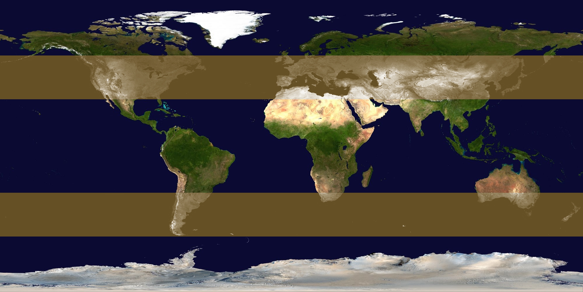
| Նկարագրում | Image identifying extratropical cyclone formation areas, between approximately 30° and 60° N/S latitude. | ||
| Թվական | |||
| Աղբյուր | background: Image:Whole world - land and oceans 12000.jpg, edit by me | ||
| Հեղինակ | Titoxd | ||
| Իրավունքներ (Նիշքի վերաօգտագործումը) |
|
Նիշքի պատմություն
Մատնահարեք օրվան/ժամին՝ նիշքի այդ պահին տեսքը դիտելու համար։
| Օր/Ժամ | Մանրապատկեր | Օբյեկտի չափը | Մասնակից | Մեկնաբանություն | |
|---|---|---|---|---|---|
| ընթացիկ | 17:25, 23 Հոկտեմբերի 2006 | | 1999 × 1000 (525 ԿԲ) | Titoxd | {{information | description = Image identifying w:extratropical cyclone formation areas, between approximately 30° and 60° N/S w:latitude. | source = background: Image:Whole world - land and oceans 12000.jpg, edit by me | date = 2006-10 |
Նիշքի օգտագործում
Հետևյալ էջը հղվում է այս նիշքին՝
Նիշքի համընդհանուր օգտագործում
Հետևյալ այլ վիքիները օգտագործում են այս նիշքը՝
- Օգտագործումը ast.wikipedia.org կայքում
- Օգտագործումը cv.wikipedia.org կայքում
- Օգտագործումը en.wikipedia.org կայքում
- Օգտագործումը es.wikipedia.org կայքում
- Օգտագործումը fr.wikipedia.org կայքում
- Օգտագործումը kk.wikipedia.org կայքում
- Օգտագործումը ko.wikipedia.org կայքում
- Օգտագործումը ko.wiktionary.org կայքում
- Օգտագործումը nn.wikipedia.org կայքում
- Օգտագործումը no.wikipedia.org կայքում
- Օգտագործումը pt.wikipedia.org կայքում
- Օգտագործումը ru.wikipedia.org կայքում
- Օգտագործումը ta.wikipedia.org կայքում
- Օգտագործումը tr.wikipedia.org կայքում
- Օգտագործումը xmf.wikipedia.org կայքում
- Օգտագործումը zh.wikipedia.org կայքում