
Պատկեր:Europe map 220BC.PNG
Նախադիտման չափ՝ 628 × 599 պիքսել։ Այլ թույլտվությաններ: 251 × 240 պիքսել | 503 × 480 պիքսել | 805 × 768 պիքսել | 1143 × 1091 պիքսել.
Սկզբնական նիշք (1143 × 1091 փիքսել, նիշքի չափը՝ 77 ԿԲ, MIME-տեսակը՝ image/png)
Ամփոփում
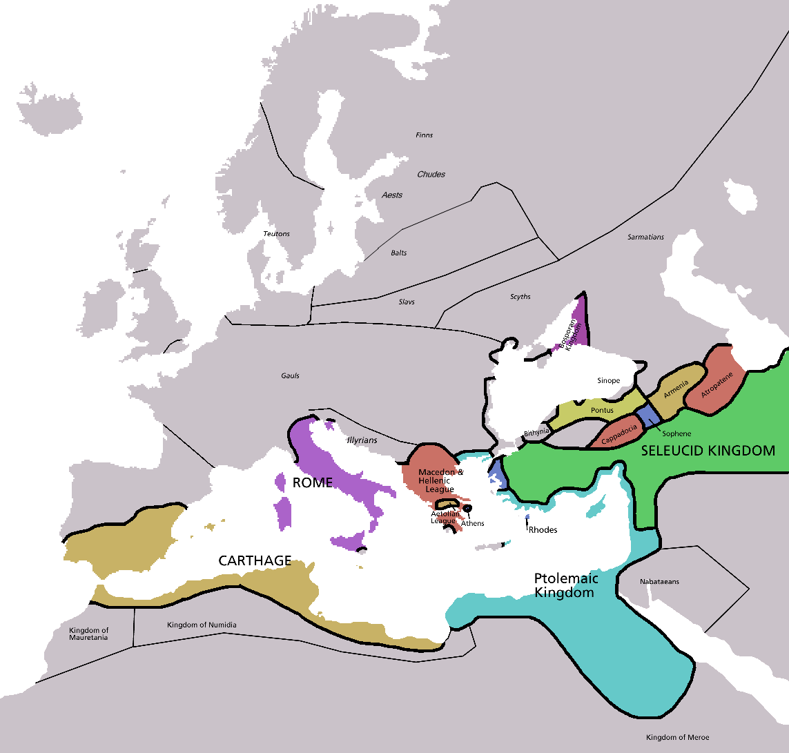
| Նկարագրում | Map of Europe in 220BC, based on free map of europe Image:BlankMap-Europe.png. Many of the border lines are approximations. |
| Թվական | |
| Աղբյուր | The Penguin Atlas of Ancient History |
| Հեղինակ | Astrokey44 |
| Այլ մեկնակերպներ | map without text, map in french |

|
This historical map image could be re-created using vector graphics as an SVG file. This has several advantages; see Commons:Media for cleanup for more information. If an SVG form of this image is available, please upload it and afterwards replace this template with
{{vector version available|new image name}}.
It is recommended to name the SVG file “Europe map 220BC.svg”—then the template Vector version available (or Vva) does not need the new image name parameter. |
_en.png)
.png)
.jpg)
Արտոնագրում

|
Այս վավերագրման պատճենահանման, տարածման և/կամ ձևափոխման թույլտվություն կամ լիցենզիայի GNU FDL պայմաններով 1.2 մեկնակերպի կամ ավելի ուշ, հրատարակված Ազատ ծրագրային ապահովության հիմնադրամում, առանց անփոփոխելի հատվածների, առանց բնագիրների, որոնք տեղադրված են առաջին և վերջին շապիկներում: Լիցենզիայի պատճենը գտնվում է GNU Free Documentation License հատվածում: |
| Այս նիշքը հասանելի է Creative Commons Attribution-Share Alike 3.0 Unported արտոնագրի ներքո: | ||
| ||
| Այս արտոնգրության հատկանիշը ավելացված է տվյալ նիշքին որպես GFDL արտոնագրի բարեփոխում: |
Նիշքի պատմություն
Մատնահարեք օրվան/ժամին՝ նիշքի այդ պահին տեսքը դիտելու համար։
| Օր/Ժամ | Մանրապատկեր | Օբյեկտի չափը | Մասնակից | Մեկնաբանություն | |
|---|---|---|---|---|---|
| ընթացիկ | 05:28, 8 փետրվարի 2011 | | 1143 × 1091 (77 ԿԲ) | Swarm | Correcting borders of Rome |
| 22:20, 4 Ապրիլի 2009 |  | 1143 × 1091 (80 ԿԲ) | DJ Sturm | Detailed Finnic peoples | |
| 03:02, 12 հունվարի 2007 |  | 1143 × 1091 (41 ԿԲ) | Roke~commonswiki | ||
| 01:38, 5 Մայիսի 2006 |  | 2285 × 2181 (140 ԿԲ) | Roke~commonswiki | Map of Europe in 220BC, based on free map of europe Image:BlankMap-Europe.png Category: Historical maps of Europe |
Նիշքի օգտագործում
Հետևյալ էջը հղվում է այս նիշքին՝
Նիշքի համընդհանուր օգտագործում
Հետևյալ այլ վիքիները օգտագործում են այս նիշքը՝
- Օգտագործումը ar.wikipedia.org կայքում
- Օգտագործումը ba.wikipedia.org կայքում
- Օգտագործումը bn.wikipedia.org կայքում
- Օգտագործումը ca.wikipedia.org կայքում
- Օգտագործումը cv.wikipedia.org կայքում
- Օգտագործումը da.wikipedia.org կայքում
- Օգտագործումը el.wikipedia.org կայքում
- Օգտագործումը en.wikipedia.org կայքում
- Օգտագործումը fr.wikipedia.org կայքում
- Օգտագործումը fy.wikipedia.org կայքում
- Օգտագործումը hu.wikipedia.org կայքում
- Օգտագործումը hyw.wikipedia.org կայքում
- Օգտագործումը id.wikibooks.org կայքում
- Օգտագործումը ko.wikipedia.org կայքում
- Օգտագործումը nl.wikipedia.org կայքում
- Օգտագործումը no.wikipedia.org կայքում
- Օգտագործումը pl.wikipedia.org կայքում
- Օգտագործումը ru.wikipedia.org կայքում
- Օգտագործումը sh.wikipedia.org կայքում
- Օգտագործումը simple.wikipedia.org կայքում
- Օգտագործումը sv.wikipedia.org կայքում
- Օգտագործումը th.wikipedia.org կայքում