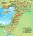
Պատկեր:Dioecesis Orientis 400 AD.png

Նախադիտման չափ՝ 554 × 600 պիքսել։ Այլ թույլտվությաններ: 222 × 240 պիքսել | 620 × 671 պիքսել.
Սկզբնական նիշք (620 × 671 փիքսել, նիշքի չափը՝ 373 ԿԲ, MIME-տեսակը՝ image/png)
Նիշքի պատմություն
Մատնահարեք օրվան/ժամին՝ նիշքի այդ պահին տեսքը դիտելու համար։
| Օր/Ժամ | Մանրապատկեր | Օբյեկտի չափը | Մասնակից | Մեկնաբանություն | |
|---|---|---|---|---|---|
| ընթացիկ | 17:48, 19 Սեպտեմբերի 2007 |  | 620 × 671 (373 ԿԲ) | Cplakidas | {{Information |Description=Map of the en:Diocese of the East (''Dioecesis Orientis'') ca. 400 AD, showing the subordinate provinces and the major cities. |Source=Base map found at en:Topographic map#Global 1-kilometer map, otherwise self-made. |
Նիշքի օգտագործում
Հետևյալ 2 էջերը հղվում են այս նիշքին՝
Նիշքի համընդհանուր օգտագործում
Հետևյալ այլ վիքիները օգտագործում են այս նիշքը՝
- Օգտագործումը ar.wikipedia.org կայքում
- Օգտագործումը ast.wikipedia.org կայքում
- Օգտագործումը azb.wikipedia.org կայքում
- Օգտագործումը ba.wikipedia.org կայքում
- Օգտագործումը be.wikipedia.org կայքում
- Օգտագործումը bg.wikipedia.org կայքում
- Օգտագործումը bn.wikipedia.org կայքում
- Օգտագործումը br.wikipedia.org կայքում
- Օգտագործումը ca.wikipedia.org կայքում
- Օգտագործումը cy.wikipedia.org կայքում
- Օգտագործումը de.wikipedia.org կայքում
- Օգտագործումը el.wikipedia.org կայքում
- Օգտագործումը en.wikipedia.org կայքում
- Decapolis
- Orient
- Bilad al-Sham
- Arab Christians
- Coele-Syria
- Al-Harith ibn Jabalah
- Antiochia ad Cragum
- Limes Arabicus
- List of revolutions and rebellions
- Mesopotamia (Roman province)
- Diocese of the East
- History of the Roman Empire
- History of Palestine
- Syria Prima
- Al-Mundhir III ibn al-Harith
- History of the Romans in Arabia
- Samaritan revolts
- Euphratensis
- Palaestina Salutaris
- Classical Anatolia
- Transjordan (region)
Տեսնել այս նիշքի ավելի համընդհանուր օգտագործումը:
