
Պատկեր:Derbyshire outline map with UK.png

Նախադիտման չափ՝ 407 × 599 պիքսել։ Այլ թույլտվությաններ: 163 × 240 պիքսել | 326 × 480 պիքսել | 819 × 1205 պիքսել.
Սկզբնական նիշք (819 × 1205 փիքսել, նիշքի չափը՝ 185 ԿԲ, MIME-տեսակը՝ image/png)
Ամփոփում

|
This locator map image could be re-created using vector graphics as an SVG file. This has several advantages; see Commons:Media for cleanup for more information. If an SVG form of this image is available, please upload it and afterwards replace this template with
{{vector version available|new image name}}.
It is recommended to name the SVG file “Derbyshire outline map with UK.svg”—then the template Vector version available (or Vva) does not need the new image name parameter. |
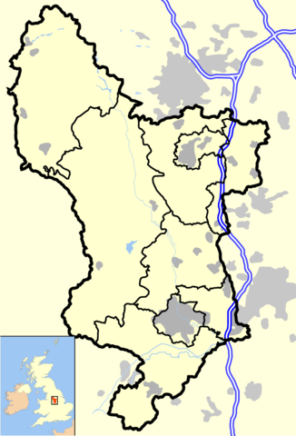
Derbyshire outline, showing motorways and urban areas. Derived from Open Street Map.
UK outline is Image:Uk outline map.png, which is licenced under the GFDL.
Արտոնագրում
Ես, սույն աշխատանքի հեղինակային իրավունքների տերը, այսուհետ այն հրատարակում եմ հետևյալ արտոնագրի ներքո։
This file is licensed under the Creative Commons Attribution-Share Alike 2.0 Generic license.
- Դուք ազատ եք՝
- կիսվել ստեղծագործությամբ – պատճենել, տարածել և փոխանցել այս աշխատանքը։
- վերափոխել – ադապտացնել աշխատանքը
- Պահպանելով հետևյալ պայմանները'
- հղում – Դուք պետք է նշեք հեղինակի (իրավատիրոջ) հղումը:
- համանման տարածում – Եթե դուք ձևափոխում եք, փոխակերպում, կամ այս աշխատանքի հիման վրա ստեղծում եք նոր աշխատանք, ապա ձեր ստեղծածը կարող է տարածվել միայն նույն կամ համարժեք թույլատրագրով։
Նիշքի պատմություն
Մատնահարեք օրվան/ժամին՝ նիշքի այդ պահին տեսքը դիտելու համար։
| Օր/Ժամ | Մանրապատկեր | Օբյեկտի չափը | Մասնակից | Մեկնաբանություն | |
|---|---|---|---|---|---|
| ընթացիկ | 22:47, 17 Ապրիլի 2007 | | 819 × 1205 (185 ԿԲ) | JeremyA | Nottinghamshire outline, showing motorways and urban areas. Derived from Open Street Map. UK outline is Image:Uk outline map.png, which is licenced under the GFDL. ==Licensing== {{self|cc-by-sa-2.0}} Category:Maps of districts in East Midlands |
Նիշքի օգտագործում
Հետևյալ էջը հղվում է այս նիշքին՝
Նիշքի համընդհանուր օգտագործում
Հետևյալ այլ վիքիները օգտագործում են այս նիշքը՝
- Օգտագործումը ba.wikipedia.org կայքում
- Օգտագործումը be.wikipedia.org կայքում
- Օգտագործումը en.wikipedia.org կայքում
- Օգտագործումը ml.wikipedia.org կայքում
- Օգտագործումը ru.wikipedia.org կայքում