
Պատկեր:Akita-Komagatake Volcano Relief Map, SRTM-1.jpg

Նախադիտման չափ՝ 800 × 533 պիքսել։ Այլ թույլտվությաններ: 320 × 213 պիքսել | 640 × 427 պիքսել | 1024 × 683 պիքսել | 1200 × 800 պիքսել.
Սկզբնական նիշք (1200 × 800 փիքսել, նիշքի չափը՝ 596 ԿԲ, MIME-տեսակը՝ image/jpeg)
Ամփոփում
| Նկարագրում |
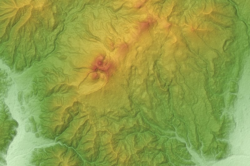
日本語: 秋田駒ヶ岳。 中央から右下にかけてが秋田駒ヶ岳火山。右上は乳頭・高倉火山群。
|
| Թվական | |
| Աղբյուր |
Topographic data: NASA's SRTM-1 30m Mesh (ver.3 2014) |
| Հեղինակ | Batholith |
| Օբյեկտի տեղագրություն | | Այս և ուրիշ պատկերներ իրենց տեղագրությամբ OpenStreetMap |
|---|
Արտոնագրում
| I, the copyright holder of this work, release this work into the public domain. This applies worldwide. In some countries this may not be legally possible; if so: I grant anyone the right to use this work for any purpose, without any conditions, unless such conditions are required by law. |
This image uses high-resolution digital topography data from NASA's Shuttle Radar Topography Mission (SRTM) at JPL-Caltech [1]. It is in the public domain in the United States.
|
 | |
| Annotations | This image is annotated: View the annotations at Commons |
Նիշքի պատմություն
Մատնահարեք օրվան/ժամին՝ նիշքի այդ պահին տեսքը դիտելու համար։
| Օր/Ժամ | Մանրապատկեր | Օբյեկտի չափը | Մասնակից | Մեկնաբանություն | |
|---|---|---|---|---|---|
| ընթացիկ | 12:52, 1 Մարտի 2016 | | 1200 × 800 (596 ԿԲ) | Batholith | {{Information |Description= {{en|Relief map of Akita-Komagatake, Prefecture, Tōhoku region, Honshu, Japan. From "SRTM-1 (30m... |
Նիշքի օգտագործում
Հետևյալ էջը հղվում է այս նիշքին՝
Նիշքի համընդհանուր օգտագործում
Հետևյալ այլ վիքիները օգտագործում են այս նիշքը՝
- Օգտագործումը en.wikipedia.org կայքում
- Օգտագործումը ja.wikipedia.org կայքում
- Օգտագործումը uk.wikipedia.org կայքում