
Պատկեր:Map of Pennsylvania highlighting Lawrence County.svg

Size of this PNG preview of this SVG file: 800 × 460 պիքսել. Այլ թույլտվությաններ: 320 × 184 պիքսել | 640 × 368 պիքսել | 1024 × 589 պիքսել | 1280 × 736 պիքսել | 2560 × 1472 պիքսել | 4950 × 2846 պիքսել.
Սկզբնական նիշք (SVG-նիշք, անվանապես 4950 × 2846 փիքսել, նիշքի չափը՝ 106 ԿԲ)
Ամփոփում
| Նկարագրում |
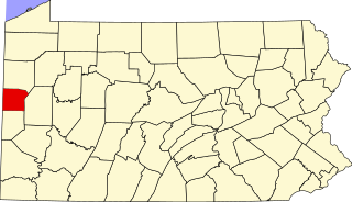
English: This is a locator map showing Lawrence County in Pennsylvania. For more information, see Commons:United States county locator maps. |
| Թվական | |
| Աղբյուր |
Բեռնողի սեփական աշխատանք: English: The maps use data from nationalatlas.gov, specifically countyp020.tar.gz on the Raw Data Download page. The maps also use state outline data from statesp020.tar.gz. The Florida maps use hydrogm020.tar.gz to display Lake Okeechobee. |
| Հեղինակ | David Benbennick |
| SVG genesis | Սա վեկտոր գրաֆիկական պատկեր է ստեղծված է եղել Other tools օգնությամբ: . |
Արտոնագրում
| I, the copyright holder of this work, release this work into the public domain. This applies worldwide. In some countries this may not be legally possible; if so: I grant anyone the right to use this work for any purpose, without any conditions, unless such conditions are required by law. |
Նիշքի պատմություն
Մատնահարեք օրվան/ժամին՝ նիշքի այդ պահին տեսքը դիտելու համար։
| Օր/Ժամ | Մանրապատկեր | Օբյեկտի չափը | Մասնակից | Մեկնաբանություն | |
|---|---|---|---|---|---|
| ընթացիկ | 16:21, 12 փետրվարի 2006 | | 4950 × 2846 (106 ԿԲ) | David Benbennick | {{subst:User:Dbenbenn/clm|county=Lawrence County|state=Pennsylvania|type=county}} |
Նիշքի օգտագործում
Հետևյալ էջը հղվում է այս նիշքին՝
Նիշքի համընդհանուր օգտագործում
Հետևյալ այլ վիքիները օգտագործում են այս նիշքը՝
- Օգտագործումը ar.wikipedia.org կայքում
- Օգտագործումը bg.wikipedia.org կայքում
- Օգտագործումը bpy.wikipedia.org կայքում
- Օգտագործումը cdo.wikipedia.org կայքում
- Օգտագործումը ceb.wikipedia.org կայքում
- Օգտագործումը cy.wikipedia.org կայքում
- Օգտագործումը de.wikipedia.org կայքում
- Օգտագործումը en.wikipedia.org կայքում
- List of counties in Pennsylvania
- Bessemer, Lawrence County, Pennsylvania
- Ellport, Pennsylvania
- Enon Valley, Pennsylvania
- Hickory Township, Lawrence County, Pennsylvania
- Little Beaver Township, Lawrence County, Pennsylvania
- Mahoning Township, Lawrence County, Pennsylvania
- Neshannock Township, Pennsylvania
- New Beaver, Pennsylvania
- New Castle, Pennsylvania
- New Castle Northwest, Pennsylvania
- New Wilmington, Pennsylvania
- North Beaver Township, Pennsylvania
- Oakland, Lawrence County, Pennsylvania
- Oakwood, Pennsylvania
- Perry Township, Lawrence County, Pennsylvania
- Plain Grove Township, Pennsylvania
- Pulaski Township, Lawrence County, Pennsylvania
- S.N.P.J., Pennsylvania
- Scott Township, Lawrence County, Pennsylvania
- Shenango Township, Lawrence County, Pennsylvania
- Slippery Rock Township, Lawrence County, Pennsylvania
- South New Castle, Pennsylvania
- Taylor Township, Lawrence County, Pennsylvania
- Union Township, Lawrence County, Pennsylvania
- Volant, Pennsylvania
- Wampum, Pennsylvania
- Washington Township, Lawrence County, Pennsylvania
- Wayne Township, Lawrence County, Pennsylvania
- Wilmington Township, Lawrence County, Pennsylvania
- Ellwood City, Pennsylvania
- Template:Lawrence County, Pennsylvania
Տեսնել այս նիշքի ավելի համընդհանուր օգտագործումը: