
Պատկեր:Map of Montana highlighting Wheatland County.svg

Size of this PNG preview of this SVG file: 800 × 461 պիքսել. Այլ թույլտվությաններ: 320 × 185 պիքսել | 640 × 369 պիքսել | 1024 × 591 պիքսել | 1280 × 738 պիքսել | 2560 × 1477 պիքսել | 9194 × 5303 պիքսել.
Սկզբնական նիշք (SVG-նիշք, անվանապես 9194 × 5303 փիքսել, նիշքի չափը՝ 122 ԿԲ)
Ամփոփում
| Նկարագրում |
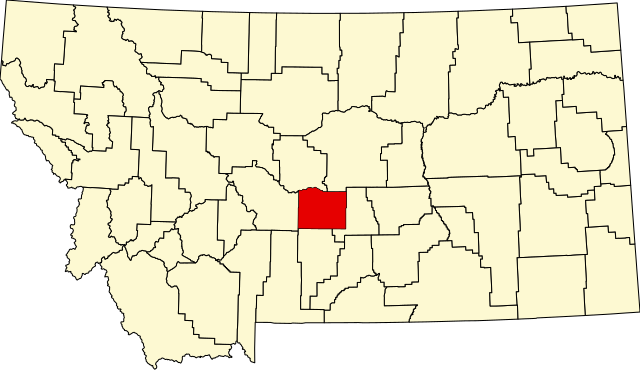
English: This is a locator map showing Wheatland County in Montana. For more information, see Commons:United States county locator maps. |
| Թվական | |
| Աղբյուր |
Բեռնողի սեփական աշխատանք: English: The maps use data from nationalatlas.gov, specifically countyp020.tar.gz on the Raw Data Download page. The maps also use state outline data from statesp020.tar.gz. The Florida maps use hydrogm020.tar.gz to display Lake Okeechobee. |
| Հեղինակ | David Benbennick |
Արտոնագրում
| I, the copyright holder of this work, release this work into the public domain. This applies worldwide. In some countries this may not be legally possible; if so: I grant anyone the right to use this work for any purpose, without any conditions, unless such conditions are required by law. |
Նիշքի պատմություն
Մատնահարեք օրվան/ժամին՝ նիշքի այդ պահին տեսքը դիտելու համար։
| Օր/Ժամ | Մանրապատկեր | Օբյեկտի չափը | Մասնակից | Մեկնաբանություն | |
|---|---|---|---|---|---|
| ընթացիկ | 13:31, 12 փետրվարի 2006 | | 9194 × 5303 (122 ԿԲ) | David Benbennick | {{subst:User:Dbenbenn/clm|county=Wheatland County|state=Montana|type=county}} |
Նիշքի օգտագործում
Հետևյալ էջը հղվում է այս նիշքին՝
Նիշքի համընդհանուր օգտագործում
Հետևյալ այլ վիքիները օգտագործում են այս նիշքը՝
- Օգտագործումը ar.wikipedia.org կայքում
- Օգտագործումը bg.wikipedia.org կայքում
- Օգտագործումը bpy.wikipedia.org կայքում
- Օգտագործումը cdo.wikipedia.org կայքում
- Օգտագործումը ceb.wikipedia.org կայքում
- Օգտագործումը cy.wikipedia.org կայքում
- Օգտագործումը de.wikipedia.org կայքում
- Օգտագործումը en.wikipedia.org կայքում
- List of counties in Montana
- Wheatland County, Montana
- Harlowton, Montana
- Judith Gap, Montana
- Twodot, Montana
- User:Nyttend/County templates/MT
- Template:Wheatland County, Montana
- List of lakes of Wheatland County, Montana
- List of mountains in Wheatland County, Montana
- Category:Populated places in Wheatland County, Montana
- Shawmut, Montana
- Duncan Ranch Colony, Montana
- Martinsdale Colony, Montana
- Springwater Colony, Montana
- Օգտագործումը es.wikipedia.org կայքում
- Օգտագործումը et.wikipedia.org կայքում
- Օգտագործումը eu.wikipedia.org կայքում
- Օգտագործումը fa.wikipedia.org կայքում
- Օգտագործումը frr.wikipedia.org կայքում
- Օգտագործումը fr.wikipedia.org կայքում
- Օգտագործումը hu.wikipedia.org կայքում
- Օգտագործումը it.wikipedia.org կայքում
- Օգտագործումը ja.wikipedia.org կայքում
- Օգտագործումը ko.wikipedia.org կայքում
- Օգտագործումը nds.wikipedia.org կայքում
- Օգտագործումը nl.wikipedia.org կայքում
- Օգտագործումը pl.wikipedia.org կայքում
Տեսնել այս նիշքի ավելի համընդհանուր օգտագործումը: