
Պատկեր:Hun Kal crater on Mercury.jpg
Նախադիտման չափ՝ 704 × 600 պիքսել։ Այլ թույլտվությաններ: 282 × 240 պիքսել | 564 × 480 պիքսել | 902 × 768 պիքսել | 1202 × 1024 պիքսել | 1294 × 1102 պիքսել.
Սկզբնական նիշք (1294 × 1102 փիքսել, նիշքի չափը՝ 310 ԿԲ, MIME-տեսակը՝ image/jpeg)
Ամփոփում
| Նկարագրում |
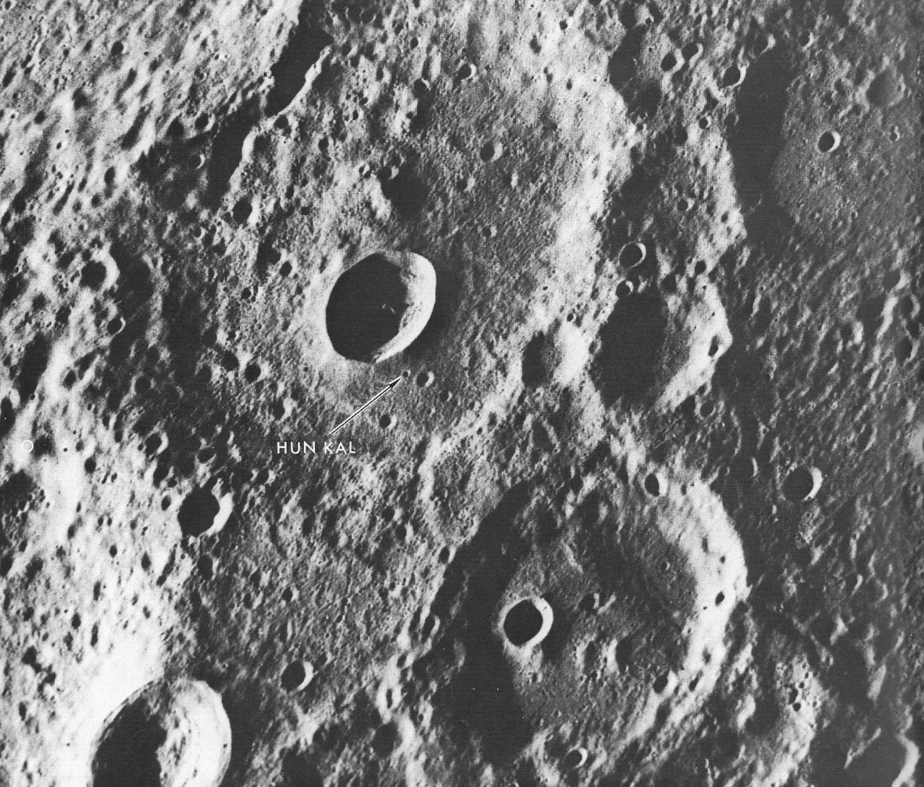
English: A fresh new crater in the center of an older crater basin provides a landmark for the tiny crater named Hun kal- the Mayan number 20 - which is the basis for positioning the longitudes on Mercury. By definition, the 20° meridian passes through the center of this small crater. Assuming that the spin axis of Mercury is perpendicular to its orbital plane, the latitude of Hun Kal is 0.23°S. This picture, which covers an area of 130 by 170 km ( 90 by 105 mi), was taken from a distance of about 20,700 km (12,860 mi), a half-hour before Mariner made its first close flyby of Mercury, March 1974. |
| Աղբյուր | http://history.nasa.gov/SP-424/p112.htm |
| Հեղինակ | Mariner 10 |
| Այլ մեկնակերպներ | cropped to show Hun Kal more plainly |
Արտոնագրում
| Այս նիշքը հանրության սեփականության է պատկանում, քանզի այն ստեղծվել է ՆԱՍԱ-ն։ ՆԱՍԱ-ի հեղինակային իրավունքների մասին քաղաքականությունը նշում է, որ «ՆԱՍԱ-ի նյութերը հեղինակային իրավունքներով պաշտպանված չեն, միթե այդպես նշված լինի»։ (Տե՛ս Template:PD-USGov, ՆԱՍԱ-ի հեղինակային իրավունքների քաղաքականության մասին էջը կամ ՋեյՓիԷլի պատկերների օգտագործման մասին քաղաքականությունը)։ | ||
 |
Զգուշացումներ՝:
|
Նիշքի պատմություն
Մատնահարեք օրվան/ժամին՝ նիշքի այդ պահին տեսքը դիտելու համար։
| Օր/Ժամ | Մանրապատկեր | Օբյեկտի չափը | Մասնակից | Մեկնաբանություն | |
|---|---|---|---|---|---|
| ընթացիկ | 21:06, 9 Ապրիլի 2008 | | 1294 × 1102 (310 ԿԲ) | Bryan Derksen | {{Information |Description={{en|A fresh new crater in the center of an older crater basin provides a landmark for the tiny crater named Hun kal- the Mayan number 20 - which is the basis for positioning the longitudes on Mercury. By definition, the 20° me |
Նիշքի օգտագործում
Հետևյալ էջը հղվում է այս նիշքին՝
Նիշքի համընդհանուր օգտագործում
Հետևյալ այլ վիքիները օգտագործում են այս նիշքը՝
- Օգտագործումը en.wikipedia.org կայքում
- Օգտագործումը fr.wikipedia.org կայքում
- Օգտագործումը ja.wikipedia.org կայքում
- Օգտագործումը ml.wikipedia.org կայքում
- Օգտագործումը pl.wikibooks.org կայքում
- Օգտագործումը ru.wikipedia.org կայքում
- Օգտագործումը zh.wikipedia.org կայքում